All of our maps are authentic antique maps, printed or drawn on or about the date shown in the description. In rare instances when we offer facsimiles, we will specifically describe the map as a later facsimile and include the date of publication. Certificates of Authenticity are included with each item.
Map Maker
Fast, Global Shipping
Last year we shipped over 4,500 antique maps to more than 50 countries. Maps are shipped Monday through Friday year-round. If an order is received before 2 PM PST, we will ship the order that day. If an order is received after that time, we will ship the next day. We ship maps either flat in custom packages or in specially ordered thick tubes. Shipping rates are provided as part of the checkout process.
Description
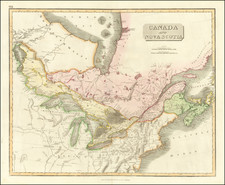
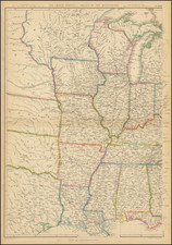
Outline color delineates counties. Shows railroads, roads, towns, rivers, forts, etc. Adam & Charles Black were among the leading publishers of atlases and travel books in the 19th Century England.


![[Uncaptioned image of two figures seated in front of a tipi, mounted albumen print]](https://storage.googleapis.com/raremaps/img/small/78744.jpg)