|
||

|

|
|

|
Porcacchi's map of North America is the earliest obtainable map of North America, preceded only by Paolo Forlani's rare map of North America, published in Venice in 1565.
Until recently, the map Forlani map had been attibuted to Bolognino Zaltieri. The Forlani includes many firsts which were repeated in the Porcacchi map, including the first detailed depiction of the Straits of Anian. The map reflects the second Cartier Voyage and early Spanish explorations in the Southwest, most notably Coronado's expedition. The treatment of the West Coast of North America, Baja California and the misdirected River flowing from the St. Lawrence area to the Atlantic are noteworthy. Porto de San Michel (San Diego) is shown. Includes compass rose and sea monsters. An essential map for North American Collectors.
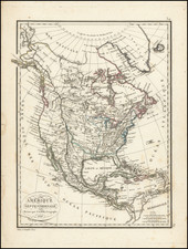
Matthäus Seutter (1678-1757) was a prominent German mapmaker in the mid-eighteenth century. Initially apprenticed to a brewer, he trained as an engraver under Johann Baptist Homann in Nuremburg before setting up shop in his native Augsburg. In 1727 he was granted the title Imperial Geographer. His most famous work is Atlas Novus Sive Tabulae Geographicae, published in two volumes ca. 1730, although the majority of his maps are based on earlier work by other cartographers like the Homanns, Delisles, and de Fer.
Alternative spellings: Matthias Seutter, Mathaus Seutter, Matthaeus Seutter, Mattheus Seutter