This item has been sold, but you can enter your email address to be notified if another example becomes available.


|
||

|

|
|

|
Stock# 0014dd
Description
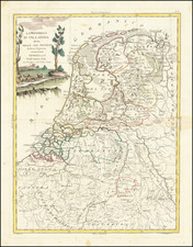
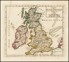
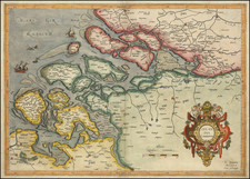
Nice example of Mount & Page's map of the Channel and contiguous British, Belgian and Dutch Coastlines.
The imprint of "W.& J.Mount & T.Page" helps date this particular example to c.1750.
The chart had first been published 1671-1672 by John Darby in John Seller's "The English Pilot". The chart extends northwards along the English coast from Rye in Kent to Holkham in Norfolk, and from Calais in France to Amsterdam, Edam and Harlingem in The Netherlands. A compass rose appears centrally on the chart and the mileage scale appears in the lower right corner.
Condition Description
Minor toning and soiling.