Search
Whereas calculating latitude, and the various ways to find that coordinate, had long been known to navigators, finding one’s longitude remained a mystery until the late-eighteenth century. European states offered rewards for adequate solutions to the longitude problem, as it affected their overseas empires and commerce. Interestingly, the problem was solved almost simultaneously by two methods, one mathematical and one mechanical.
Previously, navigators were dependent on dead reckoning. They would calculate their direction and speed and then record their estimated distance traveled on a chart or in a log. However, this method could easily go wrong, leaving ships many degrees of longitude away from where they wanted to be (or thought they were).
Longitude could be calculated on land, as time could be accurately measured there from a variety of stable observations and timekeepers. This stability was lost at sea. However, the link between local time and longitude was well established, if only local time could be told on the pitching deck of a ship. To achieve this, some sought a sea-going clock as the answer to the longitude problem. Others sought to measure the position of the Moon, which acts like a celestial clock when its movement is compared with respect to the stars or Sun.
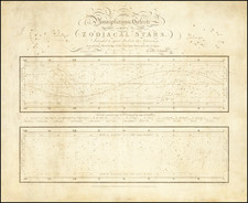
The latter method was first performed at sea by Jean-Baptiste d’Apres de Mannevillette in 1749. Mannevillette, a French naval officer, and his astronomer collaborator, Nicolas-Louis de Lacaille, published their method and lunar tables, but only for July of 1761. The publication, and the method, was taken up by Nevil Maskelyne, who was observing the Transit of Venus of 1761 in St. Helena for the Royal Society of London. Maskelyne, from 1765 the Astronomer Royal, and his assistant, Robert Waddington, realized that they needed to present this system in an accessible way. They wrote manuals and calculated lunar tables that could be easily consulted. The latter appeared in the Nautical Almanac, which has been published annually since it first appeared in 1766.
The other answer to the longitude problem was the maritime chronometer. The goal was to crate a reliable timekeeper that would keep time at sea; therefore, a navigator could compare their time measurements with those of their port of departure. Comparing the two would yield the distance of travel east or west. Many instruments makers attempted to make such a timekeeper, although the most famous is John Harrison, who eventually was awarded prizes by the Board of Longitude for his work. However, Harrison’s models never went into general production and the technology was perfected by other technicians in the final decades of the eighteenth century.
Both methods took several decades to come into common usage by mariners, however. This reflects a general trend in the history of navigation, a lag between innovation and integration of a new method or instrument. It also sheds light on the more specific history of the teaching of navigation. As explained by Margaret Schotte, from the late-fifteenth to the mid-eighteenth centuries, mariners (at least those training to be masters or navigators) underwent increasing amounts of classroom or book training to learn the more and more mathematical particulars of navigation. This sort of training did not displace practical experience at sea, but it was part of a more nuanced apprenticeship for masters that encompassed the page as well as the sextant.
Indeed, Jim Bennett calls the turn of the eighteenth century and the beginning of the nineteenth century the zenith of the mathematical seamen. However, as Schotte explained, the assumed mathematical prowess for general mariners had already started to wane by the late-eighteenth century. Mariners still trained from books, but they increasingly focused on tables and shortcuts rather than complex mathematical theory. The lunar distance tables of Maskelyne are one such aid for sailors that would save computation. From the end of the nineteenth century, instrumentation and then electronics became prevalent in navigation, largely removing the navigator from computation.
Archived