
Search
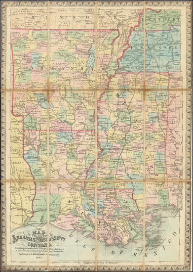
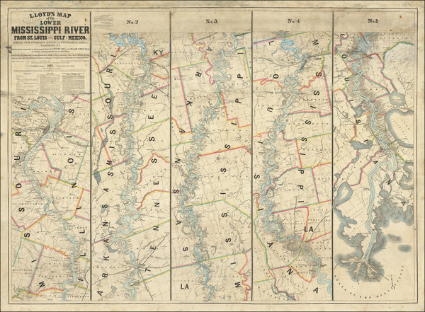
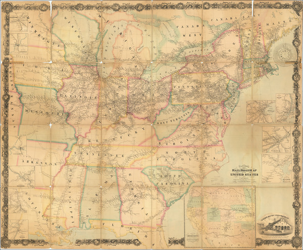
Place/Date:
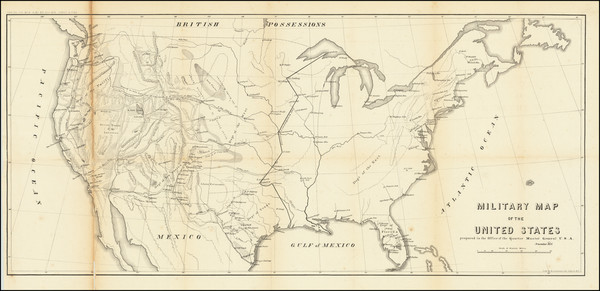
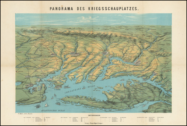
New York / 1857
Size:
30 x 13.5 inches
Condition:
VG
Stock#:
90675
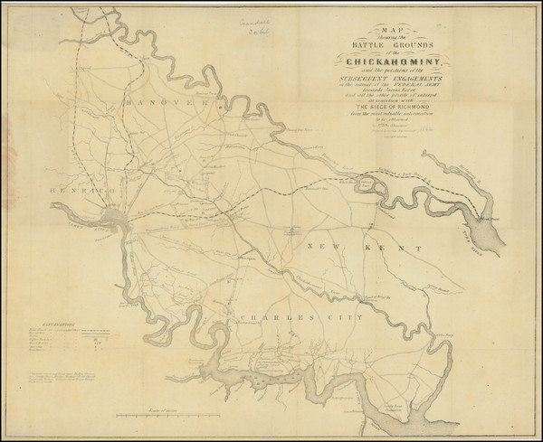
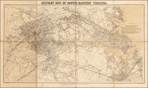
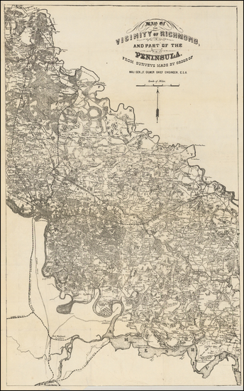
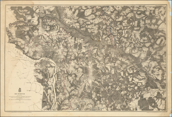
Place/Date:
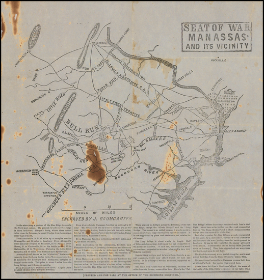
Richmond, Virginia / 1861
Size:
11 x 11.5 inches
Condition:
Good
Stock#:
47507
1861 antique Baumgarten map showing Civil War.
Place/Date:
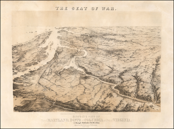
New York / 1861
Size:
20 x 16 inches
Condition:
VG
Stock#:
55643
Bachmann's 1861 antique map showing Civil War.

Place/Date:
Jackson, Mississippi / 1861
Size:
8.5 x 11 inches
Condition:
Good
Stock#:
95452

Place/Date:
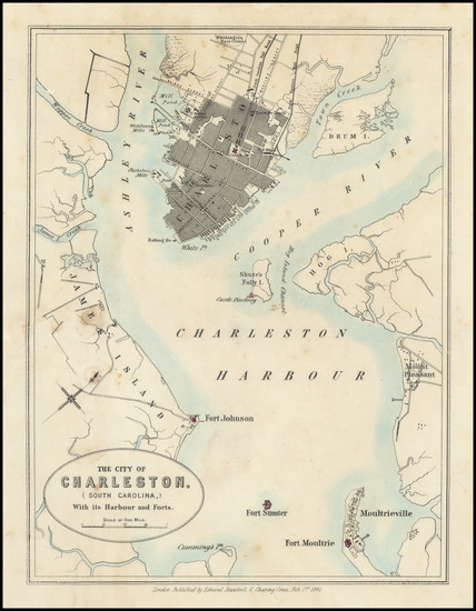
London / 1861
Size:
24.5 x 28 inches
Condition:
VG+
Stock#:
96007

Place/Date:
New York / 1861
Size:
28 x 18.75 inches
Condition:
VG
Stock#:
97895
Place/Date:
London / 1861
Size:
7.5 x 10 inches
Condition:
VG
Stock#:
98367
Place/Date:
New York / 1861
Size:
23 x 17 inches
Condition:
VG
Stock#:
101114
Place/Date:
Boston / 1861
Size:
16.5 x 19.5 inches
Condition:
VG
Stock#:
102933

Place/Date:
New York / 1861
Size:
28 x 20 inches sheet size
Condition:
VG
Stock#:
103231
Place/Date:
New York / 1862
Size:
21 x 13.5 inches
Condition:
Good
Stock#:
62644
Place/Date:
New York / 1862
Size:
48 x 30 inches
Condition:
VG
Stock#:
66495
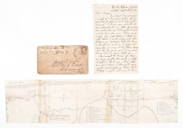
Place/Date:
Cincinnati / 1862
Size:
17.5 x 25 inches
Condition:
VG
Stock#:
67264
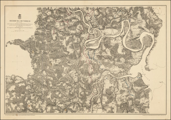
Place/Date:
Richmond, Virginia / 1862
Size:
20 x 16.5 inches
Condition:
VG
Stock#:
80374

Place/Date:
New Orleans / 1862
Size:
22 x 14.5 inches
Condition:
VG
Stock#:
88856ops
Place/Date:
Jefferson City, Mo. / 1862
Size:
19.75 x 5 inches (map)
Condition:
VG
Stock#:
93385
Place/Date:
Oshkosh, Wisconsin / 1862
Size:
16 x 22.5 inches
Condition:
VG
Stock#:
93787
Place/Date:
Stuttgart / 1862
Size:
14.25 x 11 inches
Condition:
VG
Stock#:
99760
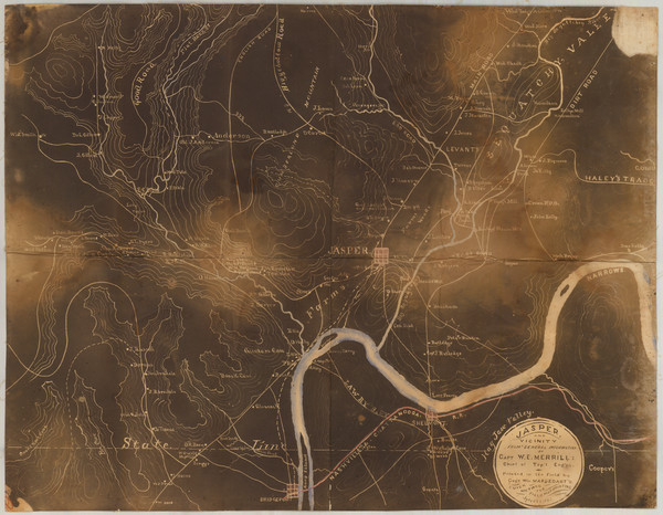
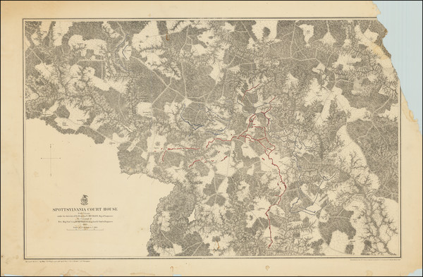
Place/Date:
Tennessee / 1863
Size:
22.5 x 17.5 inches
Condition:
VG
Stock#:
45290
Original map showing Civil War by Merrill made in 1863.
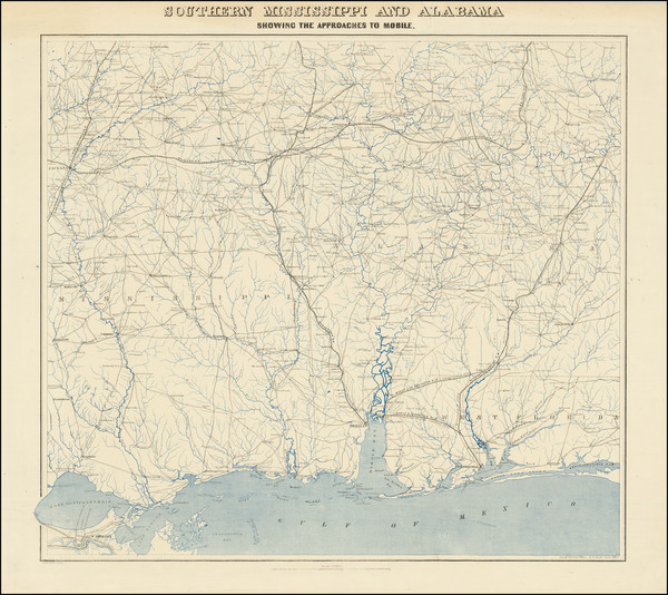
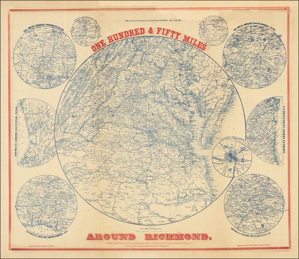
Place/Date:
Washington, DC / 1863
Size:
25 x 24 inches
Condition:
VG
Stock#:
36591mb
Antique map showing Civil War by Bache made in 1863.
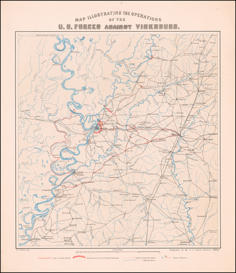
Place/Date:
Washington, D.C. / 1863
Size:
16.5 x 20.5 inches
Condition:
VG+
Stock#:
60302
1863 rare Krebs map showing Civil War.
Place/Date:
New York / 1863
Size:
38 x 24 inches
Condition:
Good
Stock#:
82609jc
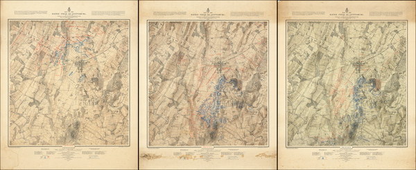
Place/Date:
Washington D.C. / 1863
Size:
39 x 23.5 inches (each sheet)
Condition:
VG
Stock#:
88214
Place/Date:
n.p. / 1863 circa
Size:
19 x 25.5 inches
Condition:
Good
Stock#:
94242
Place/Date:
Boston / 1863
Size:
27.5 x 19.5 inches
Condition:
VG
Stock#:
96097
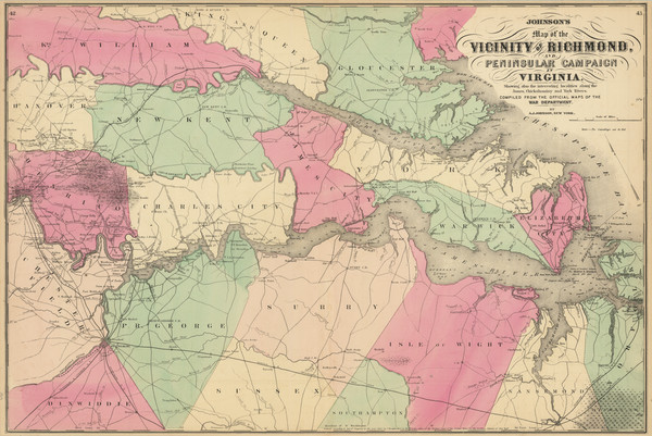
Place/Date:
New York / 1864
Size:
51 x 37 inches
Condition:
VG
Stock#:
86778mp2
1864 antique Lloyd map showing Civil War.
Place/Date:
Washington / 1864
Size:
32.5 x 18.5 inches
Condition:
VG+
Stock#:
56616
1864 rare Lindenkohl map showing Civil War.
Place/Date:
New York / 1864
Size:
30.5 x 26.5 inches
Condition:
Good
Stock#:
88225
Place/Date:
New York / 1864
Size:
26.5 x 18 inches
Condition:
VG
Stock#:
88927
Place/Date:
Philadelphia / 1864
Size:
60.75 x 50.5 inches
Condition:
Good
Stock#:
94164
Place/Date:
Philadelphia / 1864
Size:
18.5 x 23 inches
Condition:
VG+
Stock#:
96175
Place/Date:
Baltimore / 1864
Size:
23.25 x 15 inches
Condition:
Good
Stock#:
96505
Place/Date:
New York / 1864
Size:
11.75 x 18 inches (sheet size)
Condition:
Good
Stock#:
99584
Place/Date:
Washington, D.C. / 1864
Size:
21.75 x 25.5 inches
Condition:
VG+
Stock#:
102087
Place/Date:
n.p. (New York?) / 1865
Size:
20.5 x 14 inches
Condition:
Good
Stock#:
62748
Place/Date:
Philadelphia / 1865
Size:
23 x 17.5 inches
Condition:
VG+
Stock#:
96096
Place/Date:
New York / 1865
Size:
17.5 x 23 inches (sheet size)
Condition:
VG
Stock#:
96252
Place/Date:
Philadelphia / 1865
Size:
18.5 x 24 inches
Condition:
VG
Stock#:
98500
Place/Date:
n.p. / 1865
Size:
20.9 x 13.5 inches
Condition:
Good
Stock#:
101600

Place/Date:
Paris / 1865
Size:
7.7 x 11.5 inches
Condition:
VG+
Stock#:
102896
Place/Date:
n.p. / 1866
Size:
18 x 12 inches
Condition:
VG
Stock#:
45270
1866 rare Gilmer map showing Civil War.
Place/Date:
New York / 1866
Size:
32 x 21 inches
Condition:
VG+
Stock#:
93789
Place/Date:
Richmond ? / 1867
Size:
16.5 x 27 inches
Condition:
VG+
Stock#:
45226
1867 antique Gilmer map showing Civil War.
Place/Date:
New York / 1867
Size:
33 x 20 inches
Condition:
VG+
Stock#:
48980
Original map showing Civil War by United States War Dept., 1867.
Place/Date:
Washington D.C. / 1867 (1872 ca)
Size:
22 x 30.5 inches
Condition:
VG+
Stock#:
49076
Antique map showing Civil War by United States War Dept., 1867.
Place/Date:
New York / 1867 circa
Size:
25.5 x 23 inches
Condition:
VG
Stock#:
79094
Bien & Co.'s 1867 original map showing Civil War.
Place/Date:
New York / 1867
Size:
33 x 21.5 inches
Condition:
Good
Stock#:
79121
Place/Date:
New York / 1867
Size:
28.75 x 19.25 inches
Condition:
VG
Stock#:
79154
Place/Date:
New York / 1867
Size:
31 x 20 inches
Condition:
Poor
Stock#:
79170
Place/Date:
Washington / 1876
Size:
27.5 x 34 inches each
Condition:
VG
Stock#:
101769