
Search

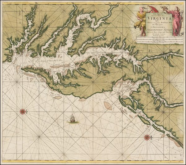
Place/Date:
Amsterdam / 1695 circa
Size:
39 x 32 inches
Condition:
VG
Stock#:
46848
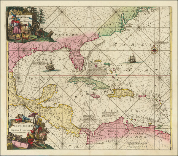
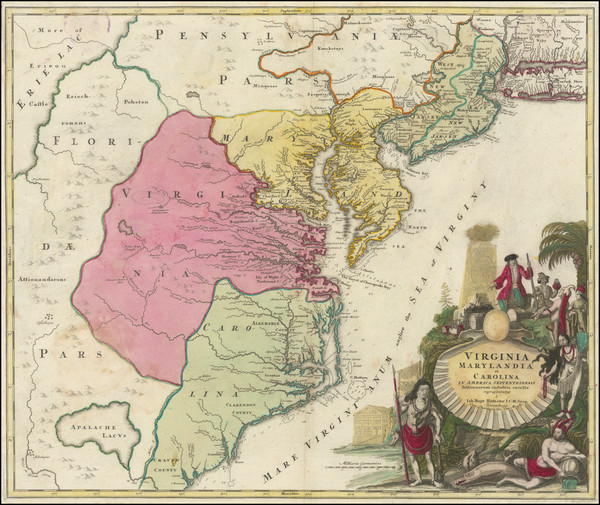
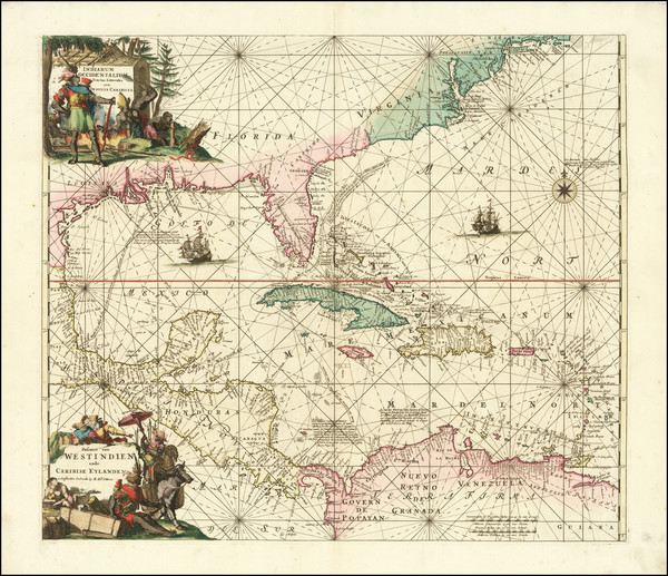
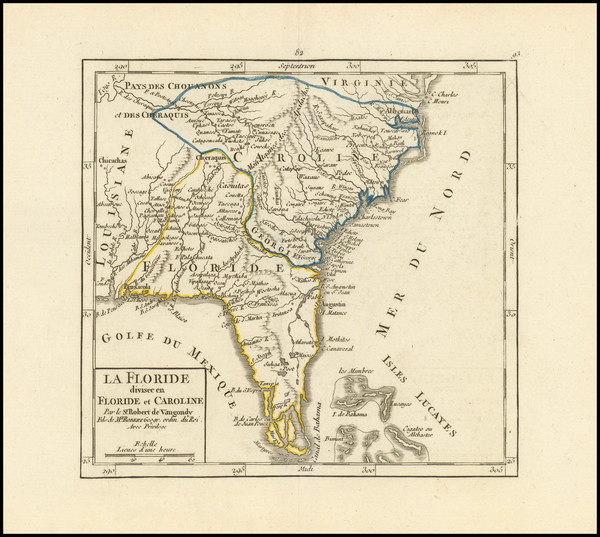
17th Century Dutch Sea Chart on Vellum
Place/Date:
Amsterdam / 1695 circa
Size:
23 x 20 inches
Condition:
VG
Stock#:
47255
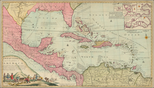
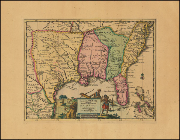
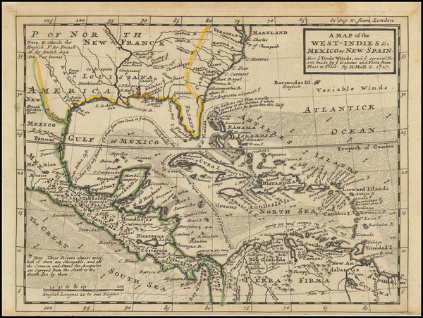
1695 original Van Keulen map showing the Southeast.
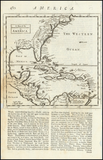
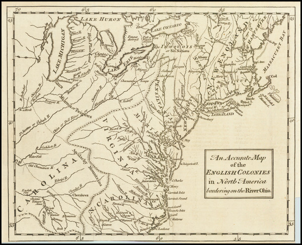
Place/Date:
London / 1695
Size:
7.5 x 11 inches
Condition:
VG
Stock#:
98200
Place/Date:
Amsterdam / 1696
Size:
23 x 18.5 inches
Condition:
Good
Stock#:
75875
Place/Date:
Amsterdam / 1696
Size:
18.5 x 22 inches
Condition:
VG
Stock#:
92254
Place/Date:
London / 1702
Size:
40 x 23.5 inches
Condition:
VG+
Stock#:
98110
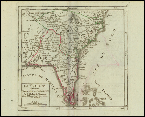
Place/Date:
Paris / 1703
Size:
25.5 x 19 inches
Condition:
VG+
Stock#:
47103
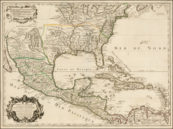
De L'Isle's 1703 antique map showing the Southeast.
Place/Date:
Paris / 1705
Size:
13 x 8.5 inches
Condition:
VG+
Stock#:
90921
Place/Date:
London / 1708
Size:
10 x 7 inches
Condition:
VG+
Stock#:
101272
Place/Date:
Amsterdam / 1710
Size:
15 x 10.5 inches
Condition:
VG
Stock#:
99070
Place/Date:
Paris / 1715
Size:
25 x 18 inches
Condition:
VG
Stock#:
59953
Antique map showing the Southeast by de Fer, 1715.
Place/Date:
Paris / 1718
Size:
25.5 x 19 inches
Condition:
VG+
Stock#:
59797
1718 rare De L'Isle map showing the Southeast.
Place/Date:
Paris / 1718
Size:
25 x 18.5 inches
Condition:
VG+
Stock#:
61193
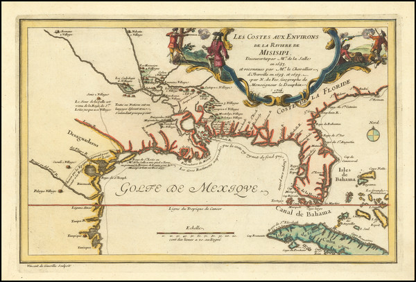
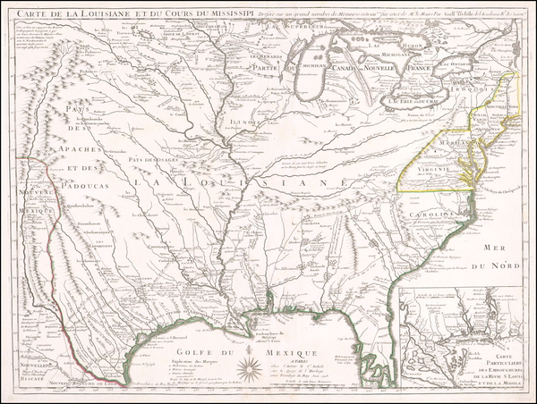
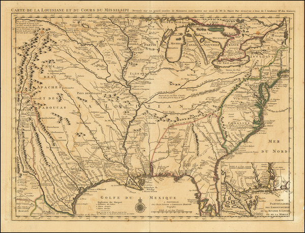
1718 Antique Map of the Mississippi River Valley During French Colonial Era
Place/Date:
Nuremberg / 1718
Size:
16.5 x 12.5 inches
Condition:
VG
Stock#:
72622
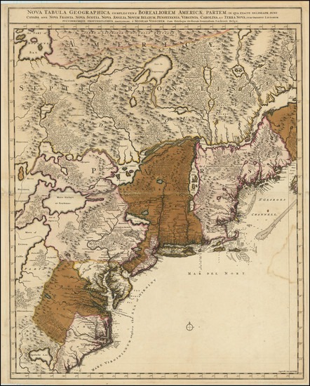
Place/Date:
Amsterdam / 1719
Size:
22 x 18 inches
Condition:
VG
Stock#:
61480
Place/Date:
London / 1719
Size:
23.5 x 20 inches
Condition:
VG
Stock#:
74465
Rare map showing the Southeast by Senex made in 1719.
Place/Date:
Amsterdam / 1719
Size:
17 x 14.5 inches
Condition:
VG+
Stock#:
93146
Place/Date:
London / 1719
Size:
22 x 19.5 inches
Condition:
VG
Stock#:
95619
Senex's 1719 antique map showing the Southeast.
Place/Date:
Nuremberg / 1720
Size:
22.5 x 19 inches
Condition:
VG+
Stock#:
73950
Place/Date:
Amsterdam / 1720
Size:
16 x 14 inches
Condition:
VG
Stock#:
79683
Place/Date:
Amsterdam / 1720
Size:
22 x 19 inches
Condition:
VG+
Stock#:
92480
Place/Date:
Nuremberg / 1720
Size:
22.5 x 19.5 inches
Condition:
VG
Stock#:
100142
Place/Date:
London / 1729
Size:
10.5 x 8 inches
Condition:
VG
Stock#:
91687
Place/Date:
London / 1729
Size:
8 x 11 inches
Condition:
VG
Stock#:
93311
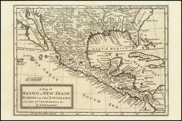
1729 antique Moll map showing the Southeast.
Place/Date:
Amsterdam / 1730
Size:
23.5 x 17.5 inches
Condition:
VG
Stock#:
75931
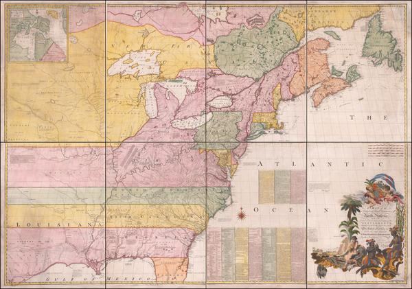
Place/Date:
London / 1733
Size:
24.5 x 40.5 inches
Condition:
VG+
Stock#:
101277
Place/Date:
Augsburg / 1740
Size:
22.5 x 19.5 inches
Condition:
Good
Stock#:
71713
Seutter's 1740 antique map showing the Southeast.
Place/Date:
Venice / 1740
Size:
17 x 13 inches
Condition:
VG+
Stock#:
84142
Place/Date:
Paris / 1744
Size:
22 x 15.5 inches
Condition:
VG+
Stock#:
84933
Place/Date:
Nuremberg / 1745
Size:
22 x 19 inches
Condition:
VG+
Stock#:
60331
Homann Heirs's 1745 original map showing the Southeast.
Place/Date:
Paris / 1745
Size:
25.5 x 19 inches
Condition:
VG
Stock#:
76340
Antique map showing the Southeast by De L'Isle / Buache made in 1745.
Place/Date:
London / 1745 circa
Size:
22.5 x 18 inches
Condition:
Good
Stock#:
92742
Place/Date:
Amsterdam / 1745
Size:
22 x 19 inches
Condition:
VG+
Stock#:
90360
Place/Date:
Paris / 1749
Size:
7 x 6.5 inches
Condition:
VG
Stock#:
97356
Place/Date:
Paris / 1749
Size:
7 x 6.5 inches
Condition:
VG+
Stock#:
99892
Place/Date:
London / 1754
Size:
10 x 8 inches
Condition:
VG
Stock#:
90978
Place/Date:
London / 1755 - 1757
Size:
76 x 53 inches If Joined
Condition:
Good
Stock#:
60574dg
Mitchell's 1755 antique map showing the Southeast.
Place/Date:
London / 1755
Size:
8 x 5.5 inches
Condition:
VG
Stock#:
81587
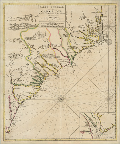
Place/Date:
Paris / 1755
Size:
24.5 x 19 inches
Condition:
VG
Stock#:
93097
Place/Date:
Nuremberg / 1755
Size:
22.5 x 16.5 inches
Condition:
VG+
Stock#:
102133
Place/Date:
Paris / 1756
Size:
13.5 x 11 inches ( Whole Sheet)
Condition:
VG
Stock#:
52293op
Gautier d'Agoty's 1756 antique map showing the Southeast.
Place/Date:
Paris / 1756
Size:
30 x 21.5 inches
Condition:
VG
Stock#:
94026
Place/Date:
Paris / 1757
Size:
11.5 x 7.5 inches
Condition:
VG+
Stock#:
76325
Bellin's 1757 rare map showing the Southeast.
Place/Date:
Paris / 1757
Size:
12 x 8.5 inches
Condition:
VG+
Stock#:
85928
Place/Date:
Paris / 1757
Size:
11.5 x 7.5 inches
Condition:
VG+
Stock#:
90059
Place/Date:
London / 1758
Size:
3.75 x 2.5 inches
Condition:
VG+
Stock#:
98228
Place/Date:
London / 1760
Size:
8.5 x 7.5 inches
Condition:
VG
Stock#:
68964
Place/Date:
London / 1761
Size:
9 x 7 inches
Condition:
VG
Stock#:
91778

Place/Date:
Livorno / 1763
Size:
7 x 10 inches
Condition:
VG+
Stock#:
69299
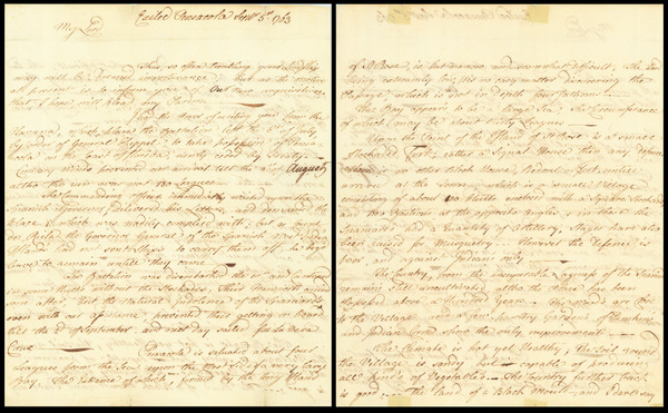
Place/Date:
Pensacola, Florida / 1763
Size:
9.25 x 15 inches
Condition:
VG
Stock#:
86620