
Search
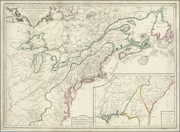
Place/Date:
Paris / 1756
Size:
30 x 21.5 inches
Condition:
VG
Stock#:
94026
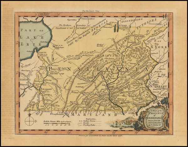
Place/Date:
London / 1756
Size:
8.5 x 7 inches
Condition:
VG
Stock#:
98226
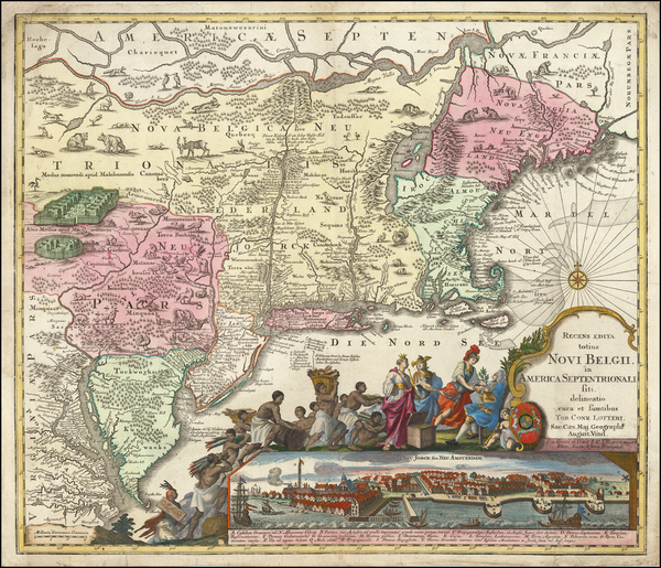
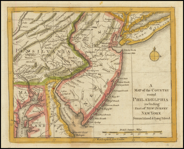
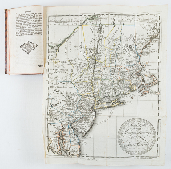
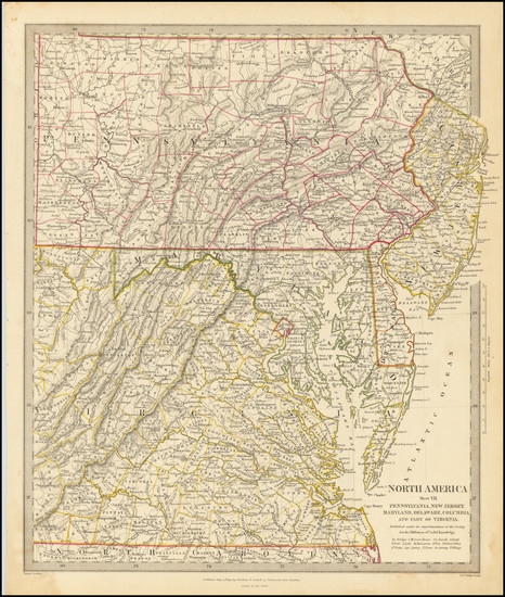
Place/Date:
Augsburg / 1757 circa
Size:
22.5 x 19.5 inches
Condition:
Good
Stock#:
63924
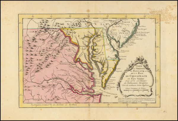
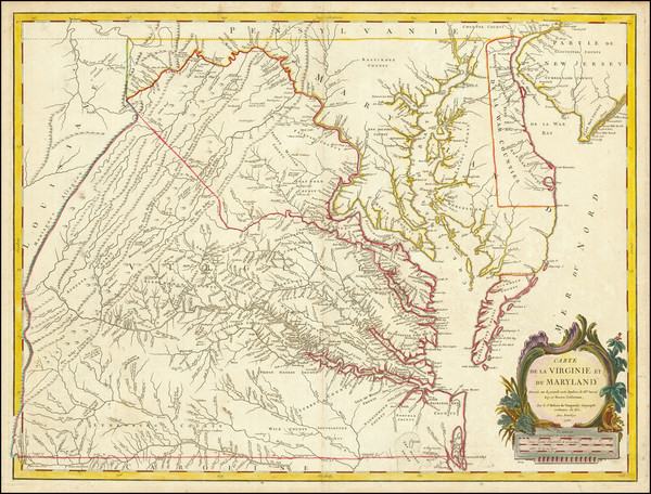
Original map showing the Mid-Atlantic by Lotter, 1757.
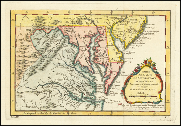
Place/Date:
Paris / 1757
Size:
11.5 x 7.5 inches
Condition:
VG+
Stock#:
76325
Bellin's 1757 rare map showing the Mid-Atlantic.
Place/Date:
London / 1757
Size:
9 x 6.5 inches
Condition:
VG+
Stock#:
82894
Place/Date:
London / 1758
Size:
3.75 x 2.5 inches
Condition:
VG+
Stock#:
98228
Place/Date:
London / 1758
Size:
3.75 x 2.5 inches
Condition:
VG+
Stock#:
98229
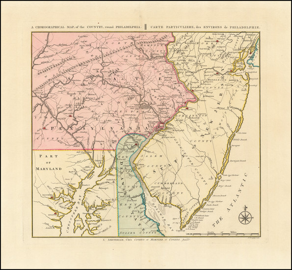
Place/Date:
London / 1759
Size:
11.5 x 8.5 inches
Condition:
VG
Stock#:
62280

Place/Date:
Edinburgh / 1767
Size:
10 x 8 inches
Condition:
VG+
Stock#:
98156
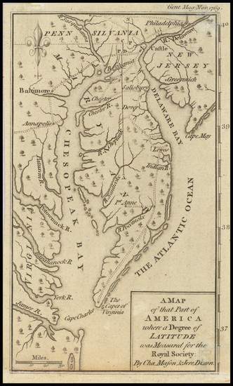
Place/Date:
London / 1769
Size:
5 x 7 inches
Condition:
VG
Stock#:
102599
Place/Date:
Amsterdam / 1770
Size:
12 x 8 inches
Condition:
Good
Stock#:
100968
Krevelt's 1770 rare map showing the Mid-Atlantic.
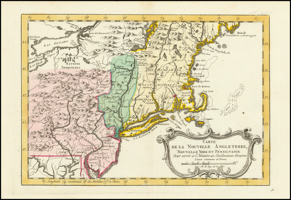
Place/Date:
Paris / 1773
Size:
12 x 8 inches
Condition:
VG+
Stock#:
99743
Place/Date:
London / 1776
Size:
22.5 x 28.5 inches
Condition:
Good
Stock#:
60351
Original map showing the Mid-Atlantic by Sauthier / Ratzer, 1776.
Place/Date:
London / 1776
Size:
9 x 7 inches
Condition:
VG+
Stock#:
86066
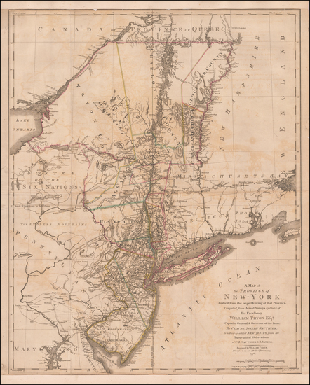
Place/Date:
London / 1776
Size:
20.5 x 43.5 inches Each Sheet
Condition:
Good
Stock#:
91422
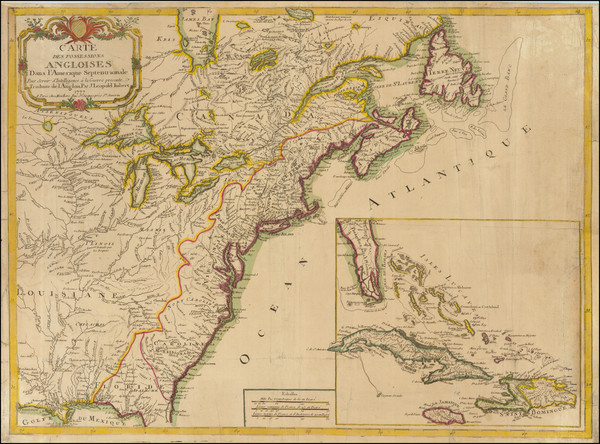
Place/Date:
London / 1777 circa
Size:
46 x 31.5 inches
Condition:
VG
Stock#:
51531
Des Barres's 1777 rare map showing the Mid-Atlantic.

Place/Date:
Augsburg / 1777
Size:
22 x 28.5 inches
Condition:
VG
Stock#:
58857
Rare map showing the Mid-Atlantic by Lotter, 1777.
Place/Date:
Paris / 1777
Size:
28.5 x 21 inches
Condition:
VG
Stock#:
89535
Place/Date:
London / 1777
Size:
11.5 x 14.5 inches
Condition:
VG
Stock#:
94252
Place/Date:
Paris / 1777
Size:
24.5 x 17 inches
Condition:
VG
Stock#:
95721
Place/Date:
Paris / 1778
Size:
20 x 26.5 inches
Condition:
VG
Stock#:
78970
Place/Date:
Paris / 1778
Size:
20.5 x 27.5 inches
Condition:
Good
Stock#:
86775
Place/Date:
Braunschweig / 1778
Size:
11.7 x 14.8 inches (map size)
Condition:
VG
Stock#:
84175
Place/Date:
Paris / 1778
Size:
25.5 x 19 inches
Condition:
VG
Stock#:
89532
Place/Date:
Amsterdam / 1778
Size:
12.5 x 12 inches
Condition:
VG+
Stock#:
92476

Place/Date:
New York / 1779
Size:
35 x 31 inches
Condition:
VG
Stock#:
51318
Antique map showing the Mid-Atlantic by Des Barres, 1779.
Place/Date:
London / 1779
Size:
8.5 x 12 inches
Condition:
VG
Stock#:
83450
Place/Date:
Paris / 1786 [1787]
Size:
23 x 23 inches (map size)
Condition:
VG+
Stock#:
51828
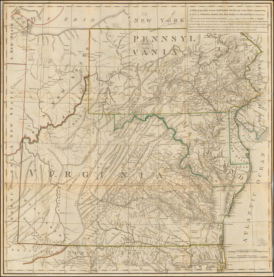
Rare map showing the Mid-Atlantic by Jefferson made in 1786.
Place/Date:
London / 1787
Size:
23 x 23 inches (Map)
Condition:
VG
Stock#:
55181
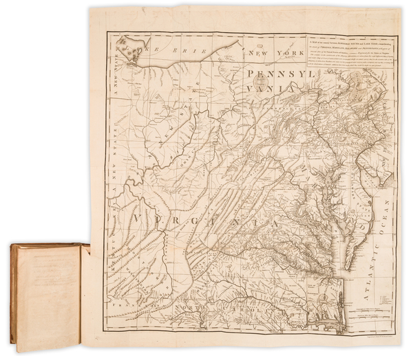
Thomas Jefferson's Map / Book on Virginia
Place/Date:
London / 1794
Size:
18 x 12 inches
Condition:
VG
Stock#:
47362
Conder's 1794 rare map showing the Mid-Atlantic.
Place/Date:
London / 1794
Size:
26 x 19.5 inches
Condition:
VG
Stock#:
49212
Laurie & Whittle's 1794 original map showing the Mid-Atlantic.
Place/Date:
Boston / 1794 (1803)
Size:
41 x 33 inches
Condition:
VG
Stock#:
55919ops
Antique map showing the Mid-Atlantic by Norman, 1794.
Place/Date:
London / 1795
Size:
12 x 8.5 inches
Condition:
VG+
Stock#:
89227
Place/Date:
London / 1796 circa
Size:
25 x 19 inches
Condition:
VG
Stock#:
50850
Antique map showing the Mid-Atlantic by Bowles & Evans made in 1796.
Place/Date:
London / 1798
Size:
18.5 x 16 inches
Condition:
VG
Stock#:
81546
Place/Date:
Paris / 1799
Size:
20 x 13 inches
Condition:
VG
Stock#:
73326rd

Place/Date:
London / 1802
Size:
9.5 x 7.25 inches
Condition:
VG
Stock#:
95082
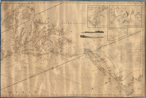
Place/Date:
London / 1805
Size:
20.5 x 18 inches
Condition:
VG+
Stock#:
87487
Place/Date:
Philadelphia / 1813
Size:
18 x 16 inches
Condition:
VG
Stock#:
66754
Place/Date:
Edinburgh / 1814
Size:
23 x 19.5 inches
Condition:
VG
Stock#:
83869

Place/Date:
Sweden / 1816
Size:
20.5 x 15 inches
Condition:
VG+
Stock#:
64709

Place/Date:
London / 1818
Size:
28 x 20 inches
Condition:
VG
Stock#:
46588
Pinkerton's 1818 original map showing the Mid-Atlantic.
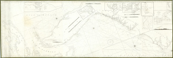
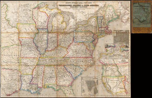
Place/Date:
New York / 1825 circa
Size:
86 x 29 inches
Condition:
VG
Stock#:
77294

Place/Date:
Madrid / 1826
Size:
36.5 x 24.5 inches
Condition:
VG
Stock#:
48746
Direccion Hidrografica de Madrid's 1826 rare map showing the Mid-Atlantic.
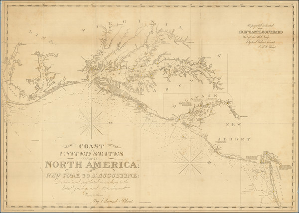
Place/Date:
New York / 1827 (1840)
Size:
37 x 26.5 inches
Condition:
VG+
Stock#:
84684
Place/Date:
London / 1830 circa
Size:
47 x 31.5 inches
Condition:
VG+
Stock#:
55819
Norie's 1830 rare map showing the Mid-Atlantic.
Place/Date:
Baltimore / 1838 circa
Size:
20.5 x 27 inches
Condition:
VG
Stock#:
45033
Soiecki's 1838 antique map showing the Mid-Atlantic.
Place/Date:
London / 1844
Size:
13 x 15 inches
Condition:
VG+
Stock#:
76586
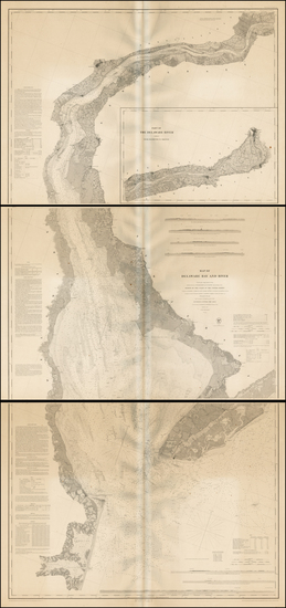
Place/Date:
Washington / 1848
Size:
35.5 x 77 inches (if joined)
Condition:
VG
Stock#:
0004sh
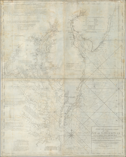
1848 rare U.S. Coast Survey map showing the Mid-Atlantic.
Place/Date:
Bamberg / 1852
Size:
21.5 x 29 inches
Condition:
VG
Stock#:
48081
Antique map showing the Mid-Atlantic by Buchnerschen Buchhandlung, 1852.