
Search
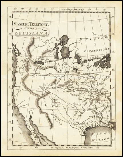
Place/Date:
Philadelphia / 1810
Size:
15 x 17.5 inches
Condition:
VG
Stock#:
73229
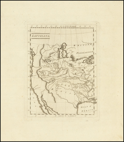
Place/Date:
Philadelphia / 1810
Size:
29.25 x 9 inches
Condition:
VG+
Stock#:
81745
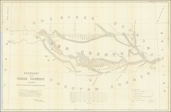
Place/Date:
Washington, DC / 1874
Size:
17.5 x 25.5 inches
Condition:
VG
Stock#:
77274
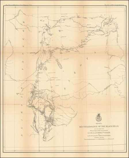
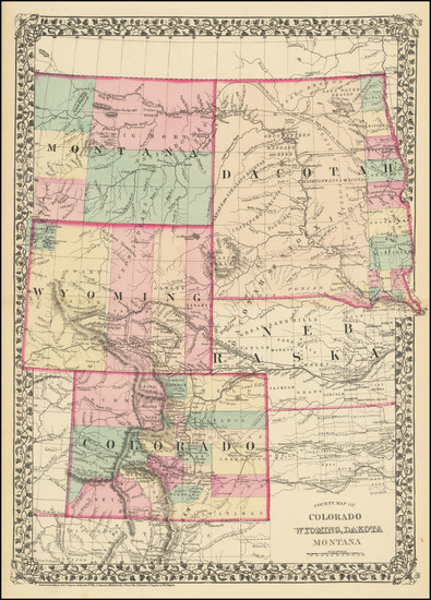
Place/Date:
Washington / 1858
Size:
23 x 20 inches
Condition:
VG
Stock#:
81862
Place/Date:
Washington / 1844
Size:
32.5 x 21 inches
Condition:
VG
Stock#:
92266
Place/Date:
London / 1796
Size:
25 x 21 inches
Condition:
VG
Stock#:
102173
Place/Date:
London / 1815
Size:
27 x 12 inches (map)
Condition:
VG
Stock#:
81775
Place/Date:
Washington / 1837
Size:
15 x 21.5 inches
Condition:
VG
Stock#:
102750
Place/Date:
Washington / 1858
Size:
37 x 24 inches
Condition:
VG
Stock#:
63234
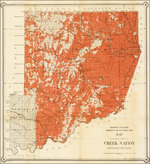
Place/Date:
Washington / 1902
Size:
27 x 29.5 inches
Condition:
VG
Stock#:
35573
Antique map showing the Plains by United States GPO made in 1902.
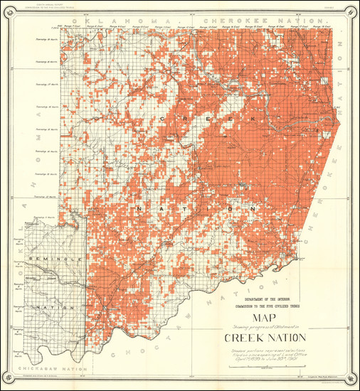
Place/Date:
Washington / 1901
Size:
27 x 29.5 inches
Condition:
VG+
Stock#:
97537

Place/Date:
Washington, D.C. / 1898
Size:
18 x 20 inches
Condition:
VG
Stock#:
49293
United States Department of the Interior's 1898 original map showing the Plains.
Place/Date:
Washington, DC / 1874
Size:
24 x 38 inches
Condition:
VG
Stock#:
82585
Place/Date:
Washington D.C. / 1904
Size:
33 x 21 inches
Condition:
VG+
Stock#:
99622
Place/Date:
New York / 1891 - 1895
Size:
27 x 16.25 inches
Condition:
VG
Stock#:
97072
Place/Date:
Washington, D.C. / 1855
Size:
23.5 x 31 inches
Condition:
Good
Stock#:
55935
Antique map showing the Plains by U.S. Pacific RR Surveys made in 1855.
Place/Date:
Washington / 1854
Size:
37 x 24.75 inches
Condition:
VG
Stock#:
49047
U.S. Pacific RR Survey's 1854 antique map showing the Plains.
Place/Date:
Washington / 1856
Size:
6 x 9 inches
Condition:
Stock#:
76162
Place/Date:
Washington, D.C. / 1901
Size:
22.5 x 13 inches
Condition:
VG+
Stock#:
49257
U.S. General Land Office's 1901 original map showing the Plains.
Place/Date:
Philadelphia / 1851
Size:
16 x 13 inches
Condition:
Good
Stock#:
95431

Place/Date:
Nottingham / 1875
Size:
35 x 25 inches
Condition:
VG
Stock#:
63292
Place/Date:
Philadelphia / 1877
Size:
15 x 20 inches
Condition:
VG+
Stock#:
89047
Place/Date:
Philadelphia / 1876
Size:
14.5 x 19.5 inches
Condition:
VG+
Stock#:
72282
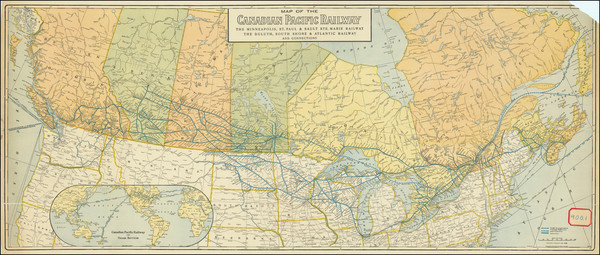
Place/Date:
Chicago / 1912
Size:
43.5 x 18.3 inches
Condition:
Good
Stock#:
90410
Place/Date:
Paris / 1835
Size:
5.5 x 6.5 inches
Condition:
VG+
Stock#:
86050
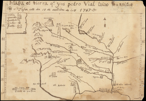
Place/Date:
n.p. / 1787 (but likely 20th Century)
Size:
11.5 x 8 inches
Condition:
Good
Stock#:
3645
Original map showing the Plains by Vial, 1787.
Place/Date:
Philadelphia / 1862
Size:
53 x 30.5 inches
Condition:
VG+
Stock#:
103211
Place/Date:
Philadelphia / 1874
Size:
27.25 x 7.75 inches
Condition:
VG
Stock#:
100916
Place/Date:
Hildburghausen / 1863 circa
Size:
16.75 x 13.25 inches
Condition:
VG+
Stock#:
99297
Place/Date:
Paris ? / 1682 (1900 circa?)
Size:
15.5 x 6.5 inches
Condition:
VG
Stock#:
93571
Place/Date:
Philadelphia / 1814
Size:
5.5 x 7.5 inches
Condition:
VG+
Stock#:
62979
Place/Date:
Philadelphia / 1805
Size:
6 x 7.5 inches
Condition:
VG+
Stock#:
83278
Place/Date:
Philadelphia / 1814
Size:
14 x 12 inches
Condition:
VG
Stock#:
103474
Carey's 1814 antique map showing the Plains.
Place/Date:
Chicago / 1892 circa
Size:
27.5 x 14.5 inches
Condition:
VG
Stock#:
65671
Place/Date:
Chicago / 1892 circa
Size:
36.5 x 14.6 inches
Condition:
VG+
Stock#:
99409
Place/Date:
London / 1837
Size:
11.5 x 9.5 inches
Condition:
VG
Stock#:
32666
Antique map showing the Plains by Bodmer, 1837.
Place/Date:
Paris, Coblenz and London / 1844 (1900 ca)
Size:
12.5 x 9 inches
Condition:
VG+
Stock#:
77699
Place/Date:
London (Leipzig?) / 1844 circa [but printed circa 1922?]
Size:
12 x 9 inches
Condition:
VG+
Stock#:
77701
Place/Date:
London (Leipzig?) / 1839 circa [but circa 1922]
Size:
12 x 9 inches
Condition:
VG
Stock#:
77702
Place/Date:
Budapest / 1858
Size:
5.5 x 8.1 inches (binding)
Condition:
VG
Stock#:
98502
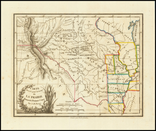
Place/Date:
New York / 1844
Size:
15.5 x 13 inches
Condition:
Good
Stock#:
98558
Place/Date:
Paris / 1950
Size:
11 x 9 inches
Condition:
VG+
Stock#:
78138
Rare map showing the Plains by Pinchon made in 1950.
Place/Date:
New York / 1855
Size:
(15 x 12) and (17 x 10)
Condition:
VG
Stock#:
37838ops
Original map showing the Plains by Moffette made in 1855.
Place/Date:
Edinburgh / 1814
Size:
24.5 x 20 inches
Condition:
VG
Stock#:
97772
Place/Date:
Philadephia / 1811
Size:
27.75 x 20 inches
Condition:
VG
Stock#:
100623
Place/Date:
London / 1755 - 1757
Size:
76 x 53 inches If Joined
Condition:
Good
Stock#:
60574dg
Mitchell's 1755 antique map showing the Plains.
Place/Date:
Paris / 1794
Size:
18.5 x 10 inches
Condition:
VG
Stock#:
98406
Place/Date:
Amsterdam / 1720
Size:
6 x 7.25 inches
Condition:
VG+
Stock#:
95924
Law's 1720 antique map showing the Plains.
Place/Date:
Baltimore and Washington, D.C. / 1845
Size:
50 x 30.5 inches (large map size)
Condition:
VG
Stock#:
88488
Place/Date:
New York / 1841
Size:
15.5 x 19.5 inches Map
Condition:
Good
Stock#:
101836