
Search
Old and antique maps of Eastern Canada for sale. Our authentic Eastern Canada map inventory features antique maps of Canada from the period of New France, the Hudson Bay Company, and early exploration by mapmakers such as Champlain. Our map inventory typically includes antique and vintage city views and plans of Montreal, Quebec, and Toronto, as well as maps of Ontario, Upper and Lower Canada, Quebec, Newfoundland and Labrador, Prince Edward Island, Nova Scotia, and New Brunswick. Vintage pictorial maps of Eastern Canada are also for sale.
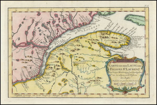
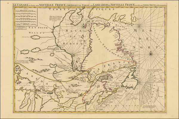
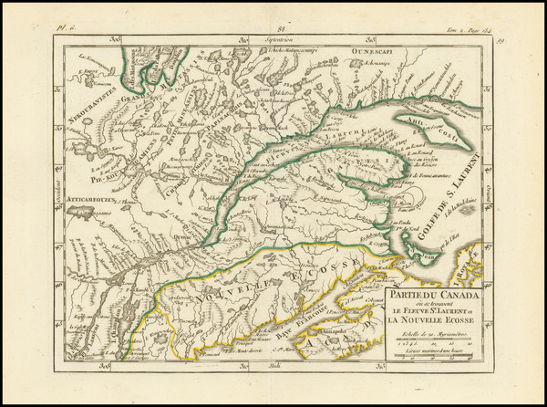
Place/Date:
Paris ? / 1757
Size:
12 x 7.5 inches
Condition:
VG
Stock#:
99757
Bellin's 1757 rare map showing Eastern Canada.
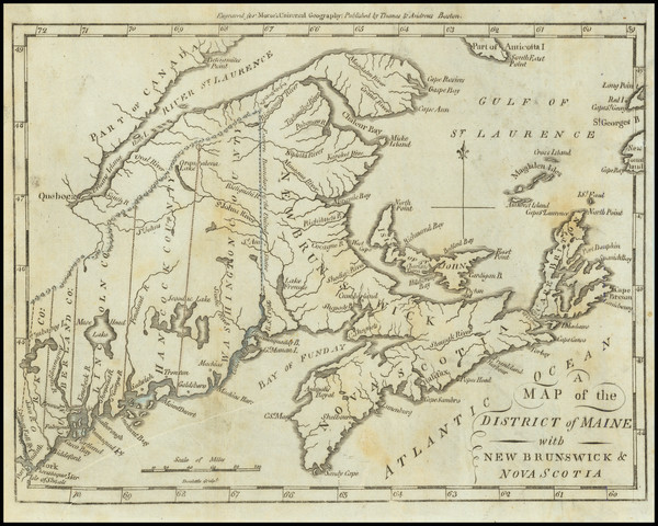
Place/Date:
Leipzig / 1756
Size:
22 x 16 inches
Condition:
VG
Stock#:
91082
Place/Date:
Washington, D.C. / 1952
Size:
27.8 x 20.4 inches
Condition:
VG+
Stock#:
98802
Place/Date:
Paris / 1656
Size:
21 x 15.5 inches
Condition:
VG
Stock#:
99318
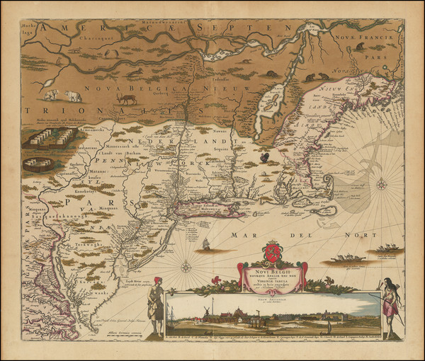
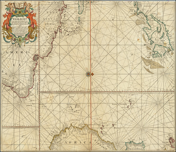
Place/Date:
Amsterdam / 1696
Size:
22.5 x 34.5 inches
Condition:
VG
Stock#:
99328
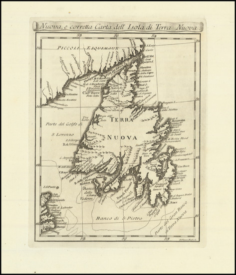
Place/Date:
Leiden / 1715
Size:
9 x 6 inches
Condition:
VG+
Stock#:
92418

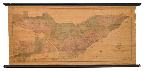
Place/Date:
Montreal / 1922
Size:
47 x 40.25 inches Including text
Condition:
VG
Stock#:
87409
Place/Date:
New York / 1836
Size:
12.5 x 11 inches
Condition:
VG+
Stock#:
70963
Place/Date:
Boston / 1838
Size:
14.5 x 11.5 inches
Condition:
VG+
Stock#:
76274
Place/Date:
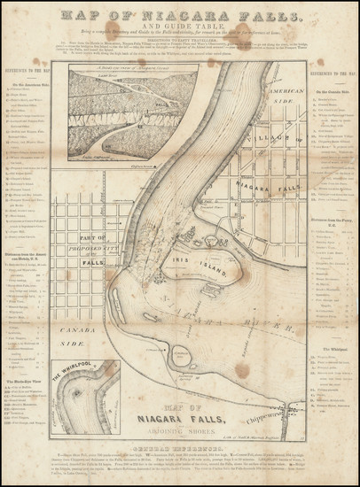
Buffalo, New York / 1840 circa
Size:
12 x 15 inches
Condition:
Good
Stock#:
94591

Place/Date:
London / 1852 circa
Size:
21.5 x 9 inches
Condition:
VG+
Stock#:
68325

Place/Date:
Toronto / 1891
Size:
27 x 21.5 inches
Condition:
VG+
Stock#:
83292
Place/Date:
Boston / 1796
Size:
9 x 7 inches
Condition:
VG
Stock#:
79663

Place/Date:
Boston / 1796
Size:
9 x 7 inches
Condition:
VG+
Stock#:
75858
Place/Date:
Scarborough, Ontario / 1974
Size:
39.5 x 29.5 inches (sheet size)
Condition:
VG+
Stock#:
95200
Place/Date:
Amsterdam / 1728
Size:
23 x 20 inches
Condition:
VG+
Stock#:
65061

Place/Date:
New York / 1836
Size:
12 x 10.5 inches
Condition:
VG+
Stock#:
70992
Place/Date:
London / 1857
Size:
16 x 13 inches
Condition:
VG+
Stock#:
102916
Place/Date:
London / 1870
Size:
17 x 13 inches
Condition:
VG+
Stock#:
94158

Place/Date:
Sweden / 1816
Size:
20.5 x 15 inches
Condition:
VG+
Stock#:
64709
Place/Date:
Amsterdam / 1745
Size:
24 x 21 inches
Condition:
VG
Stock#:
87829
Place/Date:
Amsterdam / 1737
Size:
20.5 x 22 inches
Condition:
Good
Stock#:
64717

Place/Date:
Washington, D.C. / 1951
Size:
28 x 21.5 inches
Condition:
VG
Stock#:
97067

Place/Date:
London / 1851
Size:
13 x 9.5 inches
Condition:
VG+
Stock#:
45202
Tallis's 1851 antique map showing Eastern Canada.
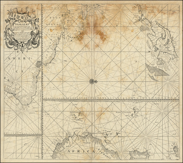
Place/Date:
Amsterdam / 1656 (1684)
Size:
22 x 18.5 inches
Condition:
VG
Stock#:
85388

Place/Date:
Amsterdam / 1684 circa
Size:
21.5 x 18.5 inches
Condition:
VG
Stock#:
93874
Place/Date:
Livorno, Italy / 1777
Size:
6.5 x 8 inches
Condition:
VG+
Stock#:
99718
Place/Date:
Paris / 1749
Size:
8 x 7 inches
Condition:
VG
Stock#:
99952
Place/Date:
Paris / 1755
Size:
24 x 20 inches
Condition:
VG
Stock#:
78836
Place/Date:
Amsterdam / 1680
Size:
23.5 x 20 inches
Condition:
VG
Stock#:
79385
Place/Date:
Amsterdam / 1680
Size:
23.5 x 20 inches
Condition:
Fair
Stock#:
94147
Place/Date:
Montreal / 1890
Size:
44 x 20.5 inches
Condition:
Good
Stock#:
103021

Place/Date:
Paris / 1764
Size:
14 x 9 inches
Condition:
VG+
Stock#:
58966
Antique map showing Eastern Canada by Bellin, 1764.
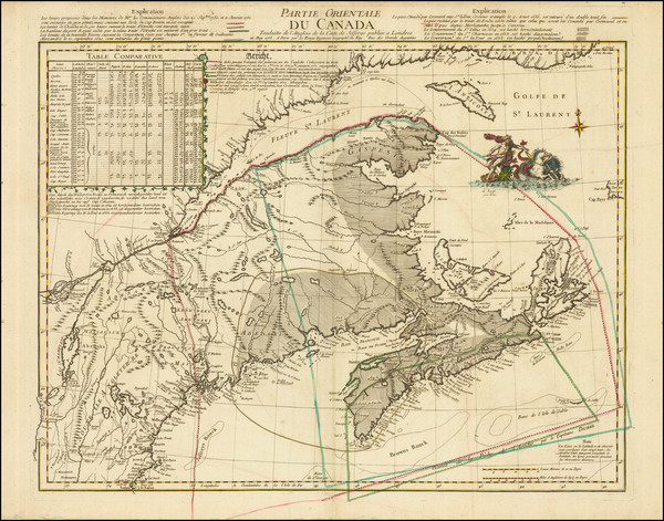
Place/Date:
Paris / 1779
Size:
17.5 x 23.5 inches
Condition:
VG
Stock#:
50750
Rare map showing Eastern Canada by Depot de la Marine made in 1779.
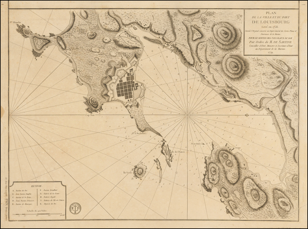
Place/Date:
Nuremberg / 1764 circa
Size:
15 x 9 inches
Condition:
VG+
Stock#:
57909
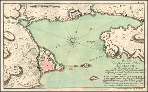
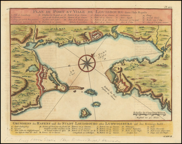
Rare map of Louisbourg
Place/Date:
Geneva / 1781
Size:
12.5 x 8.5 inches
Condition:
VG
Stock#:
39501
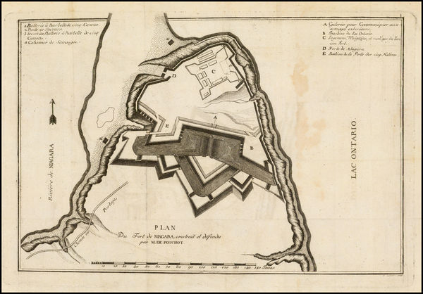
Pouchot's 1781 antique map showing Eastern Canada.
Place/Date:
Paris / 1752
Size:
11 x 9 inches
Condition:
See Description
Stock#:
99758
Bellin's 1752 antique map showing Eastern Canada.
Place/Date:
Philadelphia / 1815
Size:
19.5 x 15 inches
Condition:
Fair
Stock#:
84804

Place/Date:
Paris / 1778
Size:
22 x 15.5 inches
Condition:
VG
Stock#:
60913
1778 antique Le Rouge map showing Eastern Canada.
Place/Date:
Washington, D.C. / 1874
Size:
10 x 5.5 inches
Condition:
VG+
Stock#:
79556

Place/Date:
Paris / 1683
Size:
4 x 6.5 inches
Condition:
VG+
Stock#:
96665
Place/Date:
London / 1857
Size:
8 x 12 inches
Condition:
VG
Stock#:
102981
Place/Date:
n.p. / 1915
Size:
20 x 27.5 inches
Condition:
VG
Stock#:
103140
Place/Date:
n.p. / 1967
Size:
18 x 23 inches
Condition:
VG+
Stock#:
82287
Place/Date:
Toronto / 1846
Size:
21 x 15 inches
Condition:
Good
Stock#:
94730
Place/Date:
Paris / 1753
Size:
35 x 21.5 inches
Condition:
VG
Stock#:
54829
Antique map showing Eastern Canada by Bellin made in 1753.
Place/Date:
Venice / 1690 circa
Size:
24 x 16 inches
Condition:
VG
Stock#:
0017dg
1690 antique Coronelli map showing Eastern Canada.
Place/Date:
London / 1780
Size:
46 x 32.3 inches (if joined)
Condition:
Good
Stock#:
69631
Place/Date:
Boston / 1901
Size:
28 x 42.5 inches
Condition:
Good
Stock#:
87611
Place/Date:
London / 1856 circa
Size:
37.4 x 23.8 inches
Condition:
VG
Stock#:
85406