
Search
Rare and antique maps of Northern Germany including the states of Bremen, Hamburg, Mecklenburg-Vorpommern, Lower Saxony, and Schleswig-Holstein.

Place/Date:
Basel / 1550 circa
Size:
15.5 x 10 inches Including Text
Condition:
VG+
Stock#:
78805
Place/Date:
Basel / 1550 circa
Size:
15.25 x 10 inches (including text)
Condition:
VG
Stock#:
78931
Place/Date:
Basel / 1554 circa
Size:
12 x 10 inches
Condition:
VG+
Stock#:
81286
Place/Date:
Venice / 1562
Size:
20.5 x 15.5 inches
Condition:
VG
Stock#:
48348
Rare map showing Norddeutschland by Camocio made in 1562.
Place/Date:
Basle / 1570 circa
Size:
15 x 4 inches
Condition:
VG
Stock#:
26167
Munster's 1570 antique map showing Norddeutschland.

Place/Date:
Cologne / 1572 circa
Size:
17 x 12.5 inches
Condition:
VG
Stock#:
42108mp2
1572 antique Braun & Hogenberg map showing Norddeutschland.
Place/Date:
Cologne / 1575
Size:
19.25 x 12 inches
Condition:
VG+
Stock#:
96357
Place/Date:
Antwerp / 1575
Size:
17 x 14.5 inches
Condition:
VG+
Stock#:
99076

Place/Date:
Antwerp / 1579
Size:
4.25 x 3.25 inches
Condition:
VG
Stock#:
93293

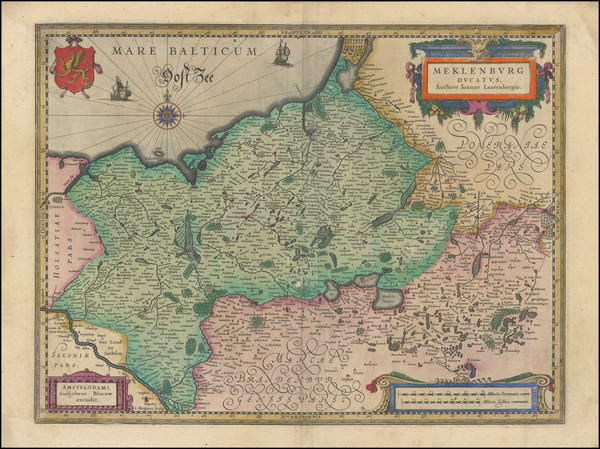
Place/Date:
Antwerp / 1581
Size:
17.5 x 12.5 inches
Condition:
VG+
Stock#:
44739
Rare map showing Norddeutschland by Ortelius made in 1581.
Place/Date:
Cologne / 1585
Size:
18 x 15 inches
Condition:
VG+
Stock#:
91201

Place/Date:
London / 1588
Size:
20 x 13 inches
Condition:
VG
Stock#:
48037
1588 antique Waghenaer / Ashley map showing Norddeutschland.
Place/Date:
Antwerp / 1588
Size:
19.5 x 13.5 inches
Condition:
VG+
Stock#:
99072
Place/Date:
Antwerp / 1588
Size:
19 x 13 inches
Condition:
VG+
Stock#:
99075
Place/Date:
Cologne / 1592
Size:
11 x 7.5 inches
Condition:
VG
Stock#:
55667
Quad / Bussemacher's 1592 original map showing Norddeutschland.
Place/Date:
Cologne / 1592 circa
Size:
11 x 7.5 inches
Condition:
VG
Stock#:
55765
1592 antique Quad / Bussemacher map showing Norddeutschland.
Place/Date:
Cologne / 1592 circa
Size:
11 x 7.5 inches
Condition:
VG
Stock#:
55815
1592 antique Quad / Bussemacher map showing Norddeutschland.
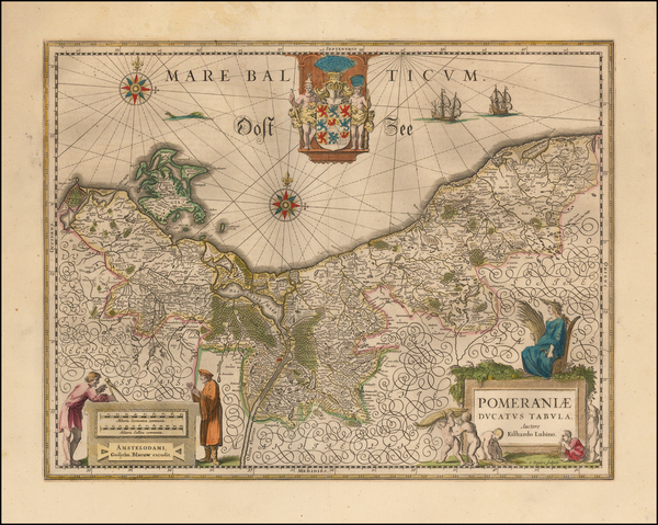
Place/Date:
Antwerp / 1595
Size:
18 x 11.5 inches
Condition:
VG+
Stock#:
61448
Place/Date:
Antwerp / 1595
Size:
20 x 13.5 inches
Condition:
VG+
Stock#:
82418
Place/Date:
Antwerp / 1595
Size:
18.5 x 12 inches
Condition:
VG+
Stock#:
85497

Place/Date:
Antwerp / 1598
Size:
19.5 x 14 inches
Condition:
VG
Stock#:
61794

Place/Date:
Antwerp / 1598
Size:
9 x 12 inches
Condition:
VG+
Stock#:
61993
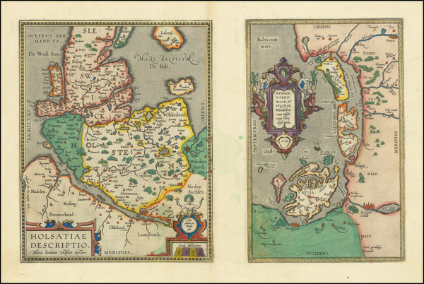
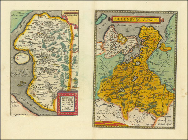
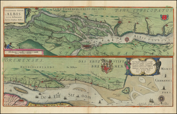
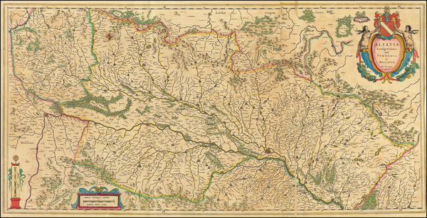
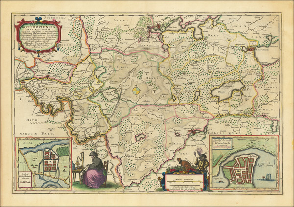
Holsatiae Descriptio [with] Rugiae Usedomiae et Iulinae Wandalicarum insularum Vera descrtiptio 1584
Place/Date:
Antwerp / 1598
Size:
19 x 12 inches
Condition:
VG+
Stock#:
83746
Place/Date:
Antwerp / 1601
Size:
19 x 13.5 inches
Condition:
VG+
Stock#:
83583
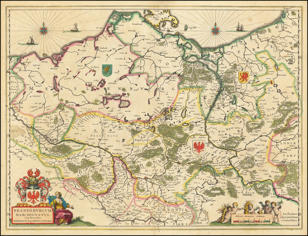
Place/Date:
Amsterdam / 1608
Size:
22 x 10 inches
Condition:
VG
Stock#:
61988
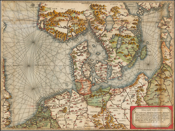
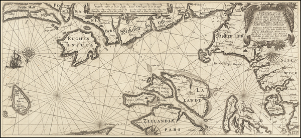
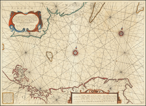
Authentic Antique Sea Chart of Fehmarn Belt, Germany, Denmark, Western Baltic, etc.

Place/Date:
Amsterdam / 1619
Size:
19 x 14 inches
Condition:
VG
Stock#:
54863
Antique map showing Norddeutschland by Mercator made in 1619.
Place/Date:
Amsterdam / 1620 circa
Size:
17 x 19.5 inches
Condition:
VG
Stock#:
42462
Antique map showing Norddeutschland by Hondius made in 1620.
Place/Date:
Amsterdam / 1624
Size:
14.5 x 10 inches
Condition:
VG
Stock#:
39851se
Rare map showing Norddeutschland by Blaeu, 1624.
Place/Date:
Amsterdam / 1628
Size:
20.75 x 12 inches
Condition:
VG
Stock#:
99230
Place/Date:
Amsterdam / 1630 circa
Size:
10 x 7.5 inches
Condition:
VG+
Stock#:
78734
Place/Date:
Amsterdam / 1630
Size:
22 x 18 inches
Condition:
VG
Stock#:
99232
Place/Date:
Amsterdam / 1630 circa
Size:
19 x 15 inches
Condition:
VG
Stock#:
99235
Place/Date:
Amsterdam / 1634 circa
Size:
19 x 14.5 inches
Condition:
VG+
Stock#:
64343op
Antique map showing Norddeutschland by Blaeu made in 1634.
Place/Date:
Amsterdam / 1634 circa
Size:
19 x 14.75 inches
Condition:
VG+
Stock#:
99174
Place/Date:
Amsterdam / 1634 circa
Size:
21.25 x 16.5 inches
Condition:
VG
Stock#:
99226
Place/Date:
Amsterdam / 1634
Size:
20 x 15 inches
Condition:
VG
Stock#:
99231
Place/Date:
Amsterdam / 1634
Size:
18.75 x 14.25 inches
Condition:
VG
Stock#:
99233
Place/Date:
Amsterdam / 1635 circa
Size:
15 x 19.5 inches
Condition:
VG
Stock#:
44124
Blaeu's 1635 antique map showing Norddeutschland.
Place/Date:
Amsterdam / 1635
Size:
31.5 x 15.5 inches
Condition:
VG
Stock#:
64768op

Place/Date:
Amsterdam / 1640 circa
Size:
14.5 x 19 inches
Condition:
VG+
Stock#:
49022
Rare map showing Norddeutschland by Jansson, 1640.
Place/Date:
Amsterdam / 1640 circa
Size:
20.5 x 15 inches
Condition:
VG
Stock#:
64230op
Antique map showing Norddeutschland by Blaeu, 1640.

Place/Date:
Amsterdam / 1640 circa
Size:
19.5 x 16 inches
Condition:
See Description
Stock#:
64307op
Place/Date:
Amsterdam / 1640 circa
Size:
21 x 15 inches
Condition:
VG+
Stock#:
67743
Place/Date:
Amsterdam / 1640
Size:
20 x 15 inches
Condition:
VG
Stock#:
99225
Place/Date:
Amsterdam / 1640
Size:
19 x 15 inches
Condition:
VG
Stock#:
99229
Place/Date:
Paris / 1644
Size:
21 x 15 inches
Condition:
VG
Stock#:
48927
1644 antique Boisseau map showing Norddeutschland.
Place/Date:
Amsterdam / 1649 circa
Size:
24 x 16 inches
Condition:
VG
Stock#:
79596
Place/Date:
Amsterdam / 1650
Size:
20.75 x 16.5 inches
Condition:
VG
Stock#:
75303
Place/Date:
Amsterdam / 1653
Size:
21.5 x 18.5 inches
Condition:
VG+
Stock#:
75380
Place/Date:
Paris / 1654
Size:
20 x 13 inches
Condition:
VG+
Stock#:
50459
Sanson's 1654 rare map showing Norddeutschland.