
Search
Place/Date:
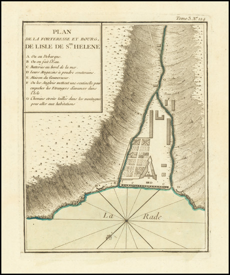
Paris / 1764
Size:
7 x 9 inches
Condition:
VG+
Stock#:
77017
Place/Date:
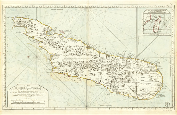
Paris / 1765
Size:
35.5 x 21.5 inches
Condition:
VG+
Stock#:
80026
Place/Date:
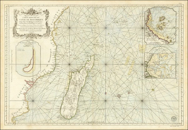
Paris / 1767
Size:
34 x 23.5 inches
Condition:
VG+
Stock#:
80030
Place/Date:
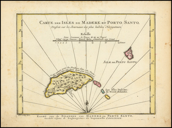
Amsterdam / 1770
Size:
8.5 x 6 inches
Condition:
VG
Stock#:
101865
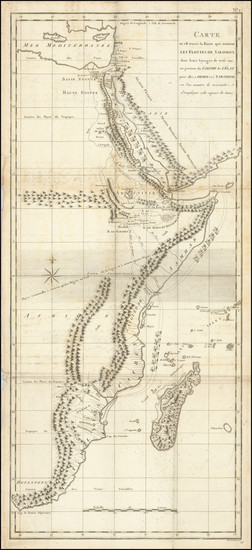
Place/Date:
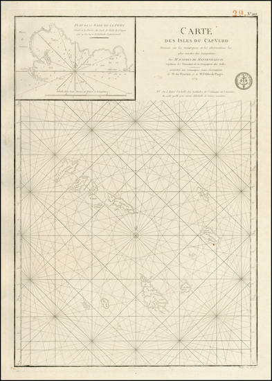
Paris / 1774
Size:
21 x 15 inches
Condition:
VG
Stock#:
23831
Antique map showing African Islands by Depot de la Marine, 1774.
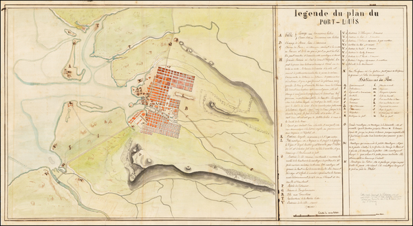
Place/Date:
Mauritius? / 1774 (1800 ca)
Size:
31.75 x 17 inches
Condition:
VG
Stock#:
51740
1774 antique Anonymous map showing African Islands.
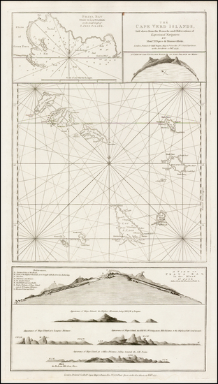
Place/Date:
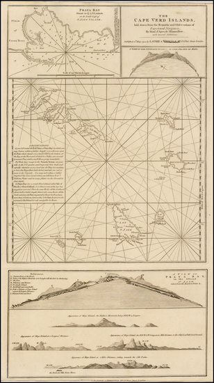
London / 1775
Size:
11 x 20.5 inches
Condition:
VG+
Stock#:
38258pb
Antique map showing African Islands by Sayer made in 1775.
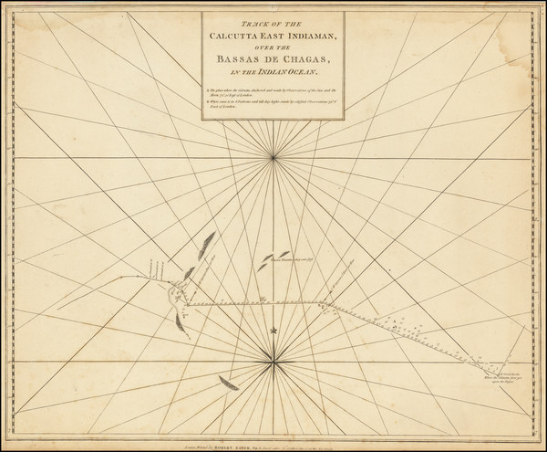
Place/Date:
London / 1780 circa
Size:
21.5 x 17.5 inches
Condition:
VG
Stock#:
66729
Place/Date:
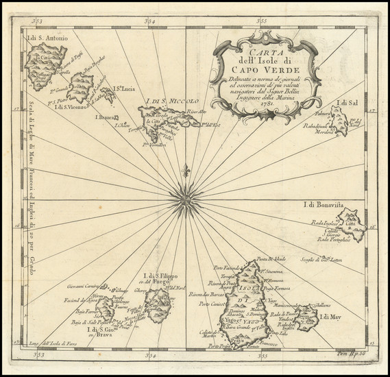
Venice / 1781
Size:
8.75 x 8.25 inches
Condition:
VG+
Stock#:
85937
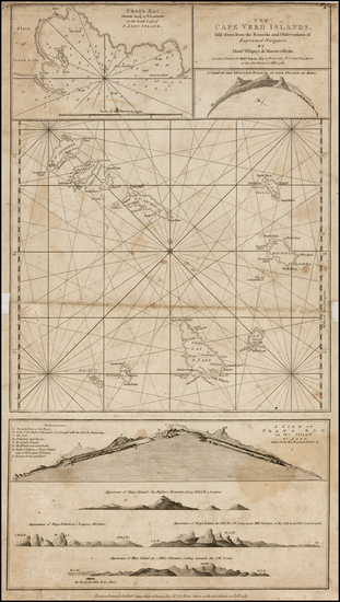
Place/Date:
London / 1782
Size:
11.5 x 21 inches
Condition:
VG-
Stock#:
32441mb
Antique map showing African Islands by Sayer made in 1782.
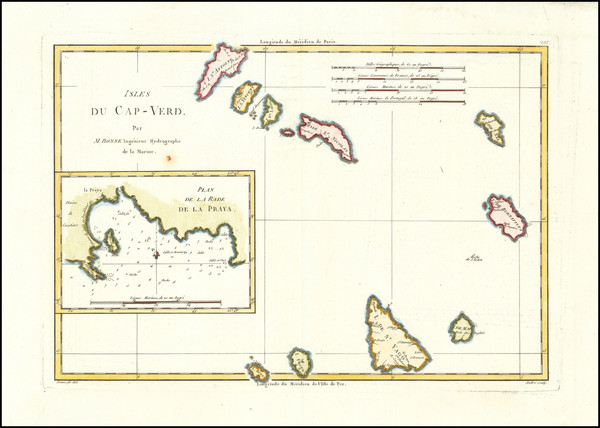
Place/Date:
Paris / 1787
Size:
13 x 9.5 inches
Condition:
VG
Stock#:
27146
1787 original Bonne map showing African Islands.
Place/Date:
Paris / 1792 circa
Size:
11.7 x 26.5 inches
Condition:
Good
Stock#:
99104
Place/Date:
London / 1794
Size:
11 x 20.5 inches
Condition:
VG
Stock#:
40528
1794 antique Laurie & Whittle map showing African Islands.
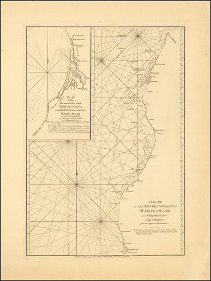
Place/Date:
London / 1794
Size:
13 x 19 inches
Condition:
VG+
Stock#:
87687
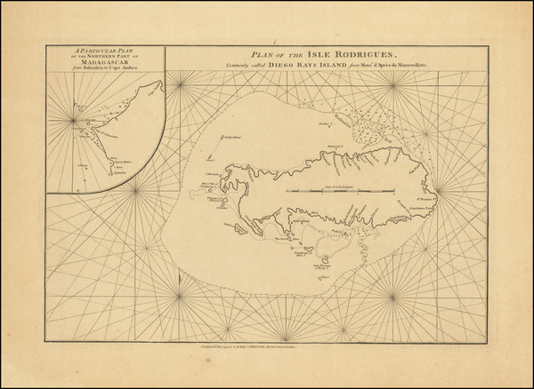
Place/Date:
London / 1794
Size:
19 x 13 inches
Condition:
VG+
Stock#:
87835
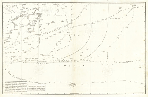
Place/Date:
London / 1814
Size:
37 x 24 inches
Condition:
VG
Stock#:
67524
Place/Date:
London / 1815
Size:
11.5 x 18.5 inches
Condition:
VG
Stock#:
50902
Wallis's 1815 rare map showing African Islands.
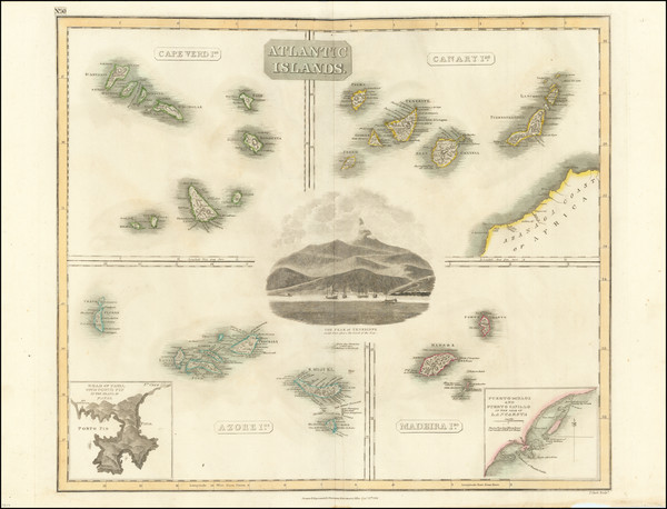
Place/Date:
Edinburgh / 1817
Size:
23.5 x 19.5 inches
Condition:
VG
Stock#:
94761
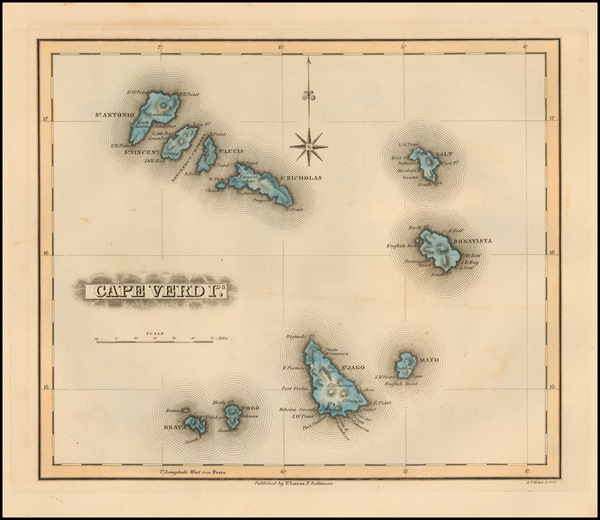
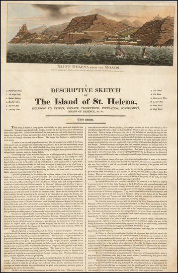
Place/Date:
Baltimore / 1823
Size:
12 x 8.5 inches
Condition:
VG+
Stock#:
55884
1823 original Lucas Jr. map showing African Islands.
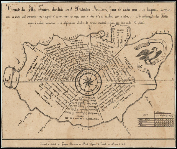
Place/Date:
Terceira ? / 1831
Size:
8 x 6.5 inches
Condition:
VG
Stock#:
77790
Place/Date:
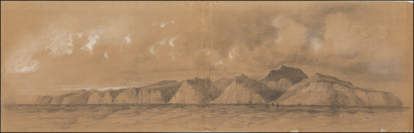
n.p. / 1842 circa
Size:
38.5 x 12.5 inches
Condition:
VG
Stock#:
37759hs
Antique map showing African Islands by Durand-Brager, 1842.
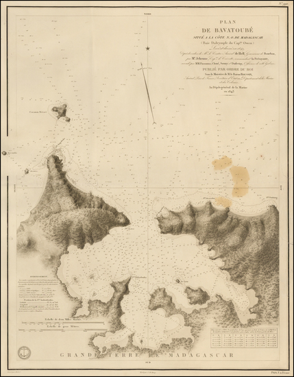
Place/Date:
Paris / 1843
Size:
23.5 x 18.5 inches
Condition:
VG
Stock#:
46417
Rare map showing African Islands by Depot de la Marine, 1843.

Place/Date:
London / 1843
Size:
18.5 x 24 inches
Condition:
VG
Stock#:
57829
British Admiralty's 1843 antique map showing African Islands.
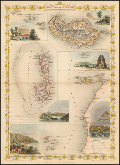
Place/Date:
London / 1851
Size:
9.5 x 13 inches
Condition:
VG+
Stock#:
48868
Original map showing African Islands by Tallis made in 1851.
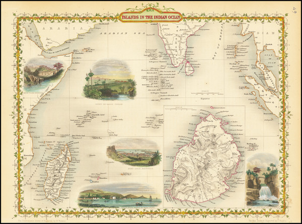
Place/Date:
London / 1851
Size:
13 x 9.5 inches
Condition:
VG+
Stock#:
67019
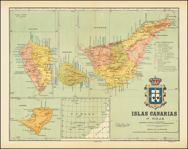
Place/Date:
Barcelona / 1900 circa
Size:
17 x 13.25 inches
Condition:
VG
Stock#:
79081
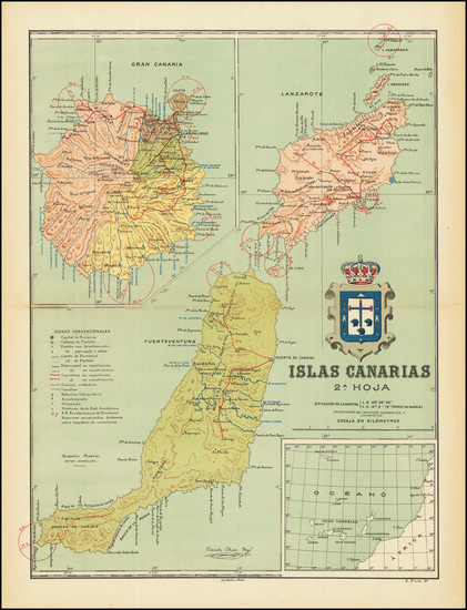
Place/Date:
Barcelona / 1900 circa
Size:
12.75 x 17 inches
Condition:
VG+
Stock#:
79083
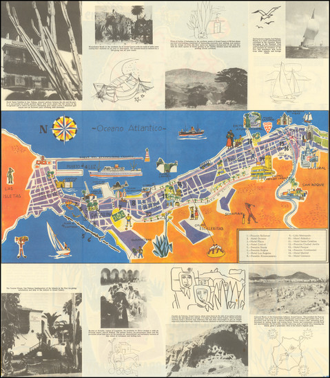
Place/Date:
Las Palmas de Gran Canaria / 1960 circa
Size:
16.25 x 9.5 inches
Condition:
VG
Stock#:
96279