|
||

|

|
|

|
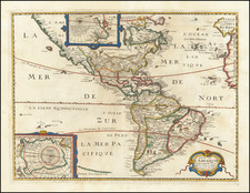
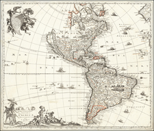
Rare wall map of America, published by Rigobert Bonne, the French Royal Hydrographer.
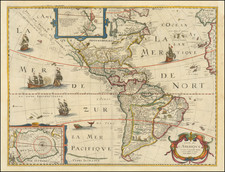
The map includes two unusual (and unnamed) rivers in the west, one flowing from the toward an unnamed Monterey Bay and the other th the Entree of Martin Aguilar. This later river suggests a continuous watercourse from Lake Superior to Lac Rouge (near the source of the Mississippi River) and then via a second river to an unnamed lake and then on to the Pacific Ocean.
A number French Forts are noted in the Old Northwest, including Ft. Checagan, Ft. des Miamis, Ft. S. Nicholas, Ft. St Fancois Xavier, Ft. Du Luth, and Ft. Pontchartrain. and Ft. Verd. Ft. Duquesne, famed as the first battle fought by George Washington, is also named.
The boundary along the Ohio River and the Mississippi River is suggestive of French claims to the region and definitely pre-dates the Treaty ending the American Revolution, where the area north of the Ohio River and west to the Mississippi River would be confirmed to the United States.
Rarity and States of the Map
We locate the following examples: John Carter Brown Library (1779), Boston Public Library (1779 and 1788); Sachisch Landesbibliotek (1786), Bibliotheque National de France (1790) and Harvard (1800).
We note editions of 1779, 1782, 1786, 1788 and 1790, and a Delamarche edition of 1800.
Rigobert Bonne (1727-1794) was an influential French cartographer of the late-eighteenth century. Born in the Lorraine region of France, Bonne came to Paris to study and practice cartography. He was a skilled cartographer and hydrographer and succeeded Jacques Nicolas Bellin as Royal Hydrographer at the Depot de la Marine in 1773. He published many charts for the Depot, including some of those for the Atlas Maritime of 1762. In addition to his work at the Depot, he is best known for his work on the maps of the Atlas Encyclopedique (1788) which he did with Nicholas Desmarest. He also made the maps for the Abbe Raynals’ famous Atlas de Toutes Les Parties Connues du Globe Terrestre (1780).
More than his individual works, Bonne is also important for the history of cartography because of the larger trends exemplified by his work. In Bonne’s maps, it is possible to see the decisive shift from the elaborate decorations of the seventeenth century and the less ornate, yet still prominent embellishments of the early to mid-eighteenth century. By contrast, Bonne’s work was simple, unadorned, and practical. This aesthetic shift, and the detail and precision of his geography, make Bonne an important figure in mapping history.