|
||

|

|
|

|
This 1780 map, created by a Mr. Medcalfe and engraved by William Faden, delineates the geographic scope of Lieutenant General Burgoyne's campaign during the pivotal year of 1777 in the American Revolutionary War. Published in London and centered around key locations from Albany to the Canadian border, the map vividly portrays the marches and principal battle sites of Burgoyne's army.
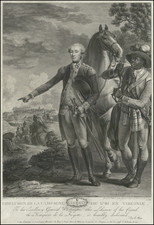
The year 1777 marked a crucial juncture in the American Revolutionary War, witnessing the British campaign led by Lieutenant General John Burgoyne. His movements and engagements, particularly at Braemus Heights and Freeman's Farm, are detailed on this map. These battles, pivotal in the Saratoga campaign, ultimately led to the British defeat and surrender at Saratoga, a turning point in the war. The depiction of these events on the map offers a strategic overview of the military maneuvers and landscape that shaped this critical phase of the conflict.
The map's coverage, extending from Lake Champlain in the north to Albany in the south, and its inclusion of specific battle dates, such as October 7th at Braemus Heights and September 19th at Freeman's Farm, add to its historical value.
Published as part of A State of the Expedition from Canada, as Laid Before the House of Commons, by Lieutenant-General Burgoyne, this map offers a detailed visual representation of a key military campaign during the American Revolutionary War.
William Faden (1749-1836) was the most prominent London mapmaker and publisher of the late-eighteenth and early-nineteenth centuries. His father, William Mackfaden, was a printer who dropped the first part of his last name due to the Jacobite rising of 1745.
Apprenticed to an engraver in the Clothworkers' Company, he was made free of the Company in August of 1771. He entered into a partnership with the family of Thomas Jeffreys, a prolific and well-respected mapmaker who had recently died in 1771. This partnership lasted until 1776.
Also in 1776, Faden joined the Society of Civil Engineers, which later changed its name to the Smeatonian Society of Civil Engineers. The Smeatonians operated as an elite, yet practical, dining club and his membership led Faden to several engineering publications, including canal plans and plans of other new engineering projects.
Faden's star rose during the American Revolution, when he produced popular maps and atlases focused on the American colonies and the battles that raged within them. In 1783, just as the war ended, Faden inherited his father's estate, allowing him to fully control his business and expand it; in the same year he gained the title "Geographer in Ordinary to his Majesty."
Faden also commanded a large stock of British county maps, which made him attractive as a partner to the Ordnance Survey; he published the first Ordnance map in 1801, a map of Kent. The Admiralty also admired his work and acquired some of his plates which were re-issued as official naval charts.
Faden was renowned for his ingenuity as well as his business acumen. In 1796 he was awarded a gold medal by the Society of Arts. With his brother-in-law, the astronomer and painter John Russell, he created the first extant lunar globe.
After retiring in 1823 the lucrative business passed to James Wyld, a former apprentice. He died in Shepperton in 1826, leaving a large estate.
![[ New England / Northeast / Canada ] Tierra Nueva](https://storage.googleapis.com/raremaps/img/small/86737.jpg)
![(New York-Robert C. Livington) [Revolutionary-Era Land Indenture]](https://storage.googleapis.com/raremaps/img/small/91957.jpg)