|
||

|

|
|

|
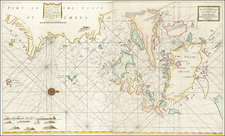
Tunison's Panorama of Japan, Corea, Manchuria & Yellow Sea, copyrighted in 1904 by H.C. Tunison, offers a comprehensive view of Northeast Asia during a crucial juncture in its history. Emphasizing Japan, Korea (then spelled Corea), Manchuria, and the expansive Yellow Sea, this map also sheds light on the surrounding regions and maritime dynamics of the time.
The turn of the 20th century witnessed Japan's emergence as a dominant imperial power in Asia, following its victory over Russia in the Russo-Japanese War of 1904-1905. This geopolitical shift was felt profoundly across the entire region, especially in Korea and Manchuria, as old allegiances were redefined and territorial ambitions grew clearer. Tunison's panoramic map, dating to 1904, captures this epoch, illustrating a region in flux, where traditional landscapes and sovereign territories became arenas of contention among aspiring global powers.
Moreover, the Yellow Sea, represented with prominence, signifies its importance as a vital maritime corridor and a stage for naval engagements, particularly during the Russo-Japanese War. This body of water, surrounded by continental landmasses, played a pivotal role in shaping the geopolitical narrative of Northeast Asia. The map, in detailing these lands and waters, provides a lens through which to understand the changing contours of power and influence in the early 20th century.
![[Shanghai & Yangtze River] Nanking, et Honan Provincie della China . . .](https://storage.googleapis.com/raremaps/img/small/46304.jpg)