


|
||

|

|
|

|
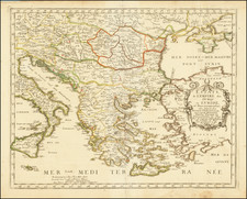
The late 18th Century was a period of enlightenment and resurgence of interest in classical antiquity. This was the era when artists, writers, and scholars revisited the glorious past of ancient civilizations to derive inspiration for the present. It was within this context that this map was created, offering an image of the Peloponnesus region and its surrounding islands as they were in classical times.
The region of Peloponnesus, shaped somewhat like a leaf, has always been an important historical, cultural, and geopolitical region in ancient Greece. The map delineates this area, namig its significant subdivisions:
-
Achaia: Located in the northern part of the peninsula, Achaia was rich in history and home to several city-states in ancient times, notably the Achaean League, a confederation of Greek city-states.
-
Argia: Presently known as Argolis, this region is located on the eastern part of the peninsula. Historically, it held the significant city of Argos, one of the oldest continuously inhabited cities in the world.
-
Arcadia: Nestled in the heart of the Peloponnese, this landlocked region is synonymous with idyllic pastoral scenes and rustic tranquility, a notion that emerged from ancient Greek mythology and pastoral literature.
-
Laconia: This region hugs the southeastern coast of the peninsula. Sparta, one of the major powers in ancient Greece, is located here.
-
Messenia: Situated to the west of Laconia, this fertile territory was historically notable for the Messenian Wars with Sparta.
Surrounding the Peloponnesus are the important waterways and islands:
-
Cephallenia: Today known as Kefalonia, this is the largest of the Ionian Islands, which holds its own unique history and significance.
-
Mare Siculum: Now called the Ionian Sea, it forms the western boundary of the Peloponnese.
-
Argolicus Sinus: This is the Gulf of Argolis, an important body of water off the eastern coast of the Peloponnesus.
-
Saronicus Sinus: Known today as the Saronic Gulf, this waterway lies between the peninsula and the region of Attica, where ancient Athens was located.
-
Sinus Corinthiacus: Presently called the Gulf of Corinth, it forms the northern boundary of the Peloponnesus.
![[The Travels of Paul] Tabula Geographica, in qua omnes regiones, urbes, oppida, et loca describuntur, quorum mentio fit in Actis et Epistolis Apostolotum, et Apocalypsi; de integro multis in locis emendata, ac regionum limitibus distincta, auct. Pet. Planc. . . .](https://storage.googleapis.com/raremaps/img/small/77970.jpg)
![[Crete] Plan de L'Isle de Candie](https://storage.googleapis.com/raremaps/img/small/77147.jpg)
![(Second World War - Balkans) Karte von Südosteuropa [Map of Southeastern Europe]](https://storage.googleapis.com/raremaps/img/small/90544.jpg)