


|
||

|

|
|

|
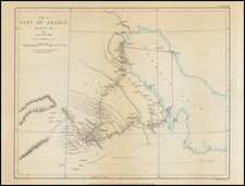
Terra Yemen maxima Pars. seu Imperii Imami, engraved by Gustav Conrad Lotter in 1774 and delineated by the renowned explorer Carsten Niebuhr, represents an important mapping of Yemen and its adjoining regions. This map, stemming from Niebuhr's expeditions, unveils the geography of the southwestern Arabian peninsula; commissioned by Danish monarchs Frederici V and Christiani VII, it breathes life into this map, establishing its historical significance in 18th-century cartography.
Carsten Niebuhr's journey from his birthplace, Lüdingworth in Bremen-Verden, to the heart of Arabia, is a testament to his profound dedication to cartographic and astronomic endeavors. His early inclination toward surveying led him to the Georgia Augusta University of Göttingen, where he encountered luminaries of the age. Johann David Michaelis, impressed by Niebuhr's potential, recommended him for the Danish Arabia expedition of 1761-1767. This venture was championed by Frederick V of Denmark, reflecting the importance European monarchs attributed to expanding geographical knowledge. Niebuhr honed his skills under the mentorship of the eminent Tobias Mayer, setting the stage for his groundbreaking contributions to geography.
Niebuhr's expeditions, while fraught with perils and marked by the demise of his colleagues, culminated in a treasure trove of geographical, historical, and cultural observations. From Cairo to Yemen, and from Mocha to Bombay, he encountered diverse civilizations and landscapes. Yemen became the epicenter of his cartographic focus. His engagement with the Imam of Yemen al-Mahdi Abbas and his adaptation to the local culture were pivotal in enhancing the accuracy and depth of his observations.
Beyond the boundaries of Yemen, Niebuhr's cartographic legacy encompassed regions like the Red Sea, the Persian Gulf, Oman, the Nile Delta, and the Gulf of Suez. The town plans he crafted offer a unique lens to the urban landscapes of the 18th century. In the annals of cartography, Niebuhr's works are lauded not merely for their geographical accuracy but also for the unparalleled insights they offer into the socio-political and cultural tapestries of the regions he explored.
Tobias Conrad Lotter (1717-1777) is one of the best-known German mapmakers of the eighteenth century. He engraved many of the maps published by Matthaus Seutter, to whose daughter Lotter was married. He took over Seutter’s business in 1756. Lotter’s son, M. A. Lotter, succeeded his father in the business.
![[Mecca and the Kaaba]](https://storage.googleapis.com/raremaps/img/small/79544.jpg)
![[ Arabian Peninsula ] Sexta Asie Tabula](https://storage.googleapis.com/raremaps/img/small/80372.jpg)
![[Ottoman map of the Arabian Peninsula]](https://storage.googleapis.com/raremaps/img/small/99778.jpg)
![[Ottoman-Turkish Map of the Middle East]](https://storage.googleapis.com/raremaps/img/small/81188.jpg)