![[Cyprus, Holy Land, Syria & Middle East] Tabula Asiae IIII By Sebastian Munster](https://storage.googleapis.com/raremaps/img/small/82782.jpg)


|
||

|

|
|

|
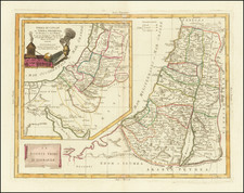
Ptolemaic Map of the Holy Land, Syria and Cyprus
Nice example of Munster's map of the Holy Land, Cyprus, Syria, etc., from the 1542 Latin edition of Munster's Geographia.
Sebastian Munster's "Tabulae Asiae IIII" offers a rich depiction of geographical knowledge Claudius Ptolemy, through the interpretive eyes of one of the 16th Century's most important geographers, Sebastian Munster.
The ancient island of Cyprus, depicted in the bottom left of the map, is remarkably well-formed, with place-names inscribed across the island providing an engaging historical snapshot. Similarly, the representation of the Holy Land is filled with historical and geographical data from ancient times, offering a detailed guide to the region as known to Ptolemy.
Syria, Mesopotamia, and Arabia each find their place on this map as well, with key cities noted in distinct text boxes.
Munster's detailing of the Arabian Desert is particularly noteworthy. Carefully rendered images of Bedouin tents, a wagon, and an oasis near the locations Raabeni and Tugaria lend an air of lived authenticity to the largely unadorned desert terrain. These illustrations serve as pictorial narratives, telling tales of nomadic life and survival in the barren landscapes, breaking the monotony of the otherwise sparse desert expanse.
Sebastian Münster (1488-1552) was a cosmographer and professor of Hebrew who taught at Tübingen, Heidelberg, and Basel. He settled in the latter in 1529 and died there, of plague, in 1552. Münster made himself the center of a large network of scholars from whom he obtained geographic descriptions, maps, and directions.
As a young man, Münster joined the Franciscan order, in which he became a priest. He then studied geography at Tübingen, graduating in 1518. He moved to Basel, where he published a Hebrew grammar, one of the first books in Hebrew published in Germany. In 1521 Münster moved again, to Heidelberg, where he continued to publish Hebrew texts and the first German-produced books in Aramaic. After converting to Protestantism in 1529, he took over the chair of Hebrew at Basel, where he published his main Hebrew work, a two-volume Old Testament with a Latin translation.
Münster published his first known map, a map of Germany, in 1525. Three years later, he released a treatise on sundials. In 1540, he published Geographia universalis vetus et nova, an updated edition of Ptolemy’s Geographia. In addition to the Ptolemaic maps, Münster added 21 modern maps. One of Münster’s innovations was to include one map for each continent, a concept that would influence Ortelius and other early atlas makers. The Geographia was reprinted in 1542, 1545, and 1552.
He is best known for his Cosmographia universalis, first published in 1544 and released in at least 35 editions by 1628. It was the first German-language description of the world and contained 471 woodcuts and 26 maps over six volumes. Many of the maps were taken from the Geographia and modified over time. The Cosmographia was widely used in the sixteenth and seventeenth centuries. The text, woodcuts, and maps all influenced geographical thought for generations.