


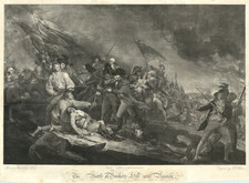
|
||

|

|
|

|
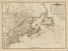
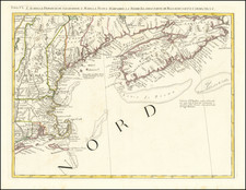
Rare early map of New England and New York, published by Robert Morden.
Morden's map extends from Long Island (shown as an Island) and Manhattan to Casco Bay and centered on the Connecticut River and the Boston Area.
In 1675, Morden issued an earlier map of this region of a similar size, this is the substantially improved and updated version of the map. Many new placenames appear along Long Island and the contiguous coastline and in the Cape Cod region. The course of the rivers have been corrected and a key naming a number of towns has been added. Block Island appears.
This is the second edition of the map, which includes the page number 77 in the top right corner. The first state (1687), has no page number inside the neatlines (there is a page number outside the neatlines).
Robert Morden (d. 1703) was a British map and globe maker. Little is known about his early life, although he was most likely apprenticed to Joseph Moxon. By 1671, Morden was working from the sign of the Atlas on Cornhill, the same address out of which Moxon had previously worked. Most famous for his English county maps, his geography texts, and his wall maps, Morden entered into many partnerships during his career, usually to finance larger publishing projects.


![[British Colonies in America] Carte Qui Contient Une Description Des Iles & Terres Que Les Anglois . . .[maps of Chesapeake, Carolinas, New England, Bermuda, Gulf Coast, Jamaica, Barbadoes & Canada]](https://storage.googleapis.com/raremaps/img/small/61480.jpg)