|
||

|

|
|

|
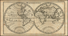
Rare Set of World Maps Including a Cordiform Map.
A nice set of modern world maps, showing two unique projections.
On the left is a world map on a North Polar Projection, showing California as an Island and extending South to include the known/incomplete coastlines of Australia and New Zealand and even a small hint of the Antarctic coast, although mythical.
On the right is a cordiform projection of the world, which was popularized in the mid-16th Century, but again with contemporary cartographic information and mis-information.
In each instance, California is curiously hooked to the mainland in the mid part of the Island, apparently hedging the prospect of its insularity in a unique and curious format.
A scarce world map, the first time we have encountered this work.
![(Anti-Nato Propaganda) Военные Блоки-Оплот Милитаризма [Military Blocs-Strongholds of Imperialism]](https://storage.googleapis.com/raremaps/img/small/94274.jpg)
![[ Early Infographic Chart ] Geography Epitomiz'd. Of The Stars And Planets. Of The Sun And Moon. Of the Air and Meteors. The Terms of Geography Explain'd.](https://storage.googleapis.com/raremaps/img/small/101679.jpg)
![(Apollo 14 - Recovery Tracking Manuscript) [Post lunar landing recovery map and related ephemera from aboard USS New Orleans including NASA issued Apollo 14 insignia patch] Apollo Mission Plotting Chart (AMP) 4th Apollo Edition, January 1969.](https://storage.googleapis.com/raremaps/img/small/76611.jpg)