|
||

|

|
|

|
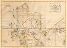
Marvelous map of the region from Lake Erie and Lake Huron and eastward.
Shows counties, towns, rivers, lakes, mountains, forts, Indian tribes, etc. One of the best regional maps of the period to appear in an American Atlas.
Bradford's atlas was a departure from other atlases of the period. Along with HS Tanner, Bradford produced an elegant, well engraved large format atlas on high quality paper. Bradford's work is without question an important part of this era. The maps were engraved by GW Boynton or S.Stiles, Sherman & Smith.
Thomas Gamaliel Bradford (1802-1887) was an American geographic publisher. He hailed from Bradford, Massachusetts and began his publishing career by working for the America Encyclopedia. Then, he edited and republished the Atlas Designed to Illustrate the Abridgement of Universal Geography, Modern & Ancient, which had originally been offered in French by Adrian Balbi. In 1835, he published another atlas, A Comprehensive Atlas: Geographical, Historical & Commercial, and, in 1838, An Illustrated Atlas Geographical, Statistical and Historical of the United States and Adjacent Countries. His interests were primarily in educational publishing and he was one of the first mapmakers to show Texas as an independent country.