This item has been sold, but you can enter your email address to be notified if another example becomes available.


|
||

|

|
|

|
Stock# 38587
Description
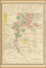
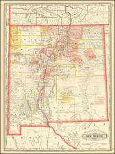
One of the earliest reasonably obtainable separately issued maps of New Mexico.
Shows early roads, rivers, towns, Indian reservations, forts, mining regions and many other early details.
Includes extensive details throughout the map, with significant information in the accompanying text pamphlet.
Includes information on land grants and mining districts, with a color code for unconfirmed grants, resevations and confirmed claims.
Condition Description
Includes original printed wrappers and text. Minor soiling.
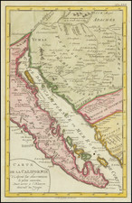
![[Arizona below New Mexico] Mexique d'apres le grand Atlas Dresse Par A.H. Dufour Grave par ch Dyonet Pubie par A. Le Chevalier . . . 1863](https://storage.googleapis.com/raremaps/img/small/64395.jpg)
![[Battle of Taos] Sketch accompanying Col. Price Despatch](https://storage.googleapis.com/raremaps/img/small/92129.jpg)