|
||

|

|
|

|
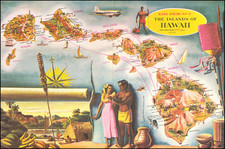
Important map of the World, issued in 1782. One of the earliest appearances of Hawaii (O-Why-hee) on a printed map.
This large and beautifully presented World Map features the tracks of all three of Captain James Cook's Voyages (1768-71, 1772-5 and 1776-80), as well as the route of the solo return voyage to Europe by the Adventure, captained by Tobias Furneaux, as part of Cook's Second Voyage.
Consequent to these voyages, the map features exciting new depictions of the Pacific, including Australia, New Zealand, Hawaii (labeled as "O-Why-Hee" - one of the very first appearances of the islands on a printed map), Polynesia and the North American Pacific Northwest. The coverage of this latter region is especially curious, as the map notes not only recent British, Spanish and Russian discoveries but also the mythical Chinese encounter with the region (the land of 'Fou-Sang'). The tentative inclusion of the "F[leuve] de l'Ouest", the rumored river that was said to run across North America is an archaic hold-out, soon to be shown not to exist.
The map was published by Matthäus Albrecht Lotter (1741-1810), the heir to one of Europe's most prolific and long lasting cartographic dynasties. He was the son of important Augsburg mapmaker Tobias Conrad Lotter (1717-77) who was, in turn, the son-in-law and heir of Matthäus Seutter (1678-1757), who had trained under the eminent cartographer Johann Baptist Homann (1664-1724). The map was engraved by eminent Matthäus Albrecht's brother, Georg Frederick Lotter. The attractive and somewhat unusual ovoid projection is based on J.B.B. D'Anville's wall map of 1761.
![[From the Library of Captain Louis Freycinet] Carte Hydrographique Des Partes Connues De La Terre Dressee sur la Projection de Mercator, Poar C.LO. Gressier , Ingenieur Hydrographe de la Marine . . . 1835 (with extensive manuscript annotations)](https://storage.googleapis.com/raremaps/img/small/58604.jpg)