|
||

|

|
|

|
Unrecorded 65 page original manuscript treatise on the Island of Panay, written by one of its longest serving Augustine Missionaries, Ramon Alvarez Junco, and accompanied by a remarkable map of the island.
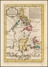
Alvarez Junco's present manuscript is a masterly discourse on the history and contemporary affairs of Panay, a major island in the Visayas region of the central Philippines. Panay has a long and storied history, being home to the Bishaya peoples, who were famous throughout East Asia for their prowess as mariners. The Spanish first established a presence on the island in 1566, and allied themselves with the Bishaya against their mutual enemies the Moro peoples. The Augustinian order established the first mission on Panay in 1590. The celebrated 'Boxer Codex' (circa 1595), which featured magnificent illustrations of the various ethnic groups in the Philippines, was produced on Panay.
The work was clearly intended as a discourse and history of the island, including both detailed first hand observations and an anecdotal hsitory of the island dating from Magellan to then modern times.
Ramón Alvarez Junco (1809-1858) was born in Laviana, Asturias, Spain. He entered the Order of St. Augustine at the College of Valladolid on September 28, 1828. In 1829, he was sent to the Philippines, where he was responsible for several parishes on the Island of Panay from 1831 to his death in Igbaras, Iloilo Province, on January 3, 1858.
He is the author of the manuscript entitled " Cronología de los señores alcaldes, corregidores, gobernadores y jueces de primera instancia que ha tenido esta provincia de Iloilo, y de otros varios sucesos ocurridos en ella desde su descubrimiento" (1853), which was later published. In addition to his writings, he was responsible for the construction of the stone arch bridge known as Taytay Tigre, near the town of Guimbal (Province of Iloilo).
The Manuscript is divided into the following sections:
- Isla de Panay (ff.1-5);
- Pueblo de Guimbal: Su primitiba Situacion (5-6),
- Su situacion actual (6),
- Su ayuntamto. Justicia Territorial (6-8),
- Presupuesto de ayuntamto (8)
- La administracion o' govierno Eclesiasto (8-9),
- Su Poblacion (9), Su Caserio (9-10),
- Edificios Publicos (10-11),
- Puentes y Calzadas (12),
- Mesones y Posadas Publicas (12),
- Calidad de su territorio (12-13),
- Calidad de sus aguas, con expresion de los rios y riuchuclos en territorio (13),
- Produciones naturales e industriales (13-14),
- Arboles medicinales su utilidad y aplicacion (14-16),
- Arbustos medicinales su utilidad y aplicacion (16-19),
- Yerbas y yerbatos medicinales su utilidad y aplicacion (19-21),
- Comercio (21),
- Artefactos (22-23),
- Clima y Vientos (23),
- Enfermedades mas communes (23-24),
- Educacion publica (24),
- Paseos, sotos, arbolados, minas, canteras, y Bolcanes (Volcanoes) (24);
- Distancia desde este Pueblo a los de la Circumferencia (24-25);
- Brebve y rapido compendio de la historia temporal y Espiritual de esta Ysla de Panay desde su descubrimto. Por Hernado Magellanes en el ano de 1520 hasta el coriente de 1850 (26-65).
The finely drafted map covers the southern coast of Panay from Miagao to Tigbauan, centered on Guimbal, and extends inland to Igbaras and beyond, up the Igbara River (interestingly, the interior areas are still today so remote that the even Google Earth has no current information on the regions north of Igbaras), and then up the Jarao River to Tubungan.
The map provides a fine topographical image of the region, showing many churches, roads, towns, rivers, mountains and other details.