


|
||

|

|
|

|
A highly-decorative large-format map of the province of Upper Bavaria, which includes the city of Munich.
The map depicts all of upper Bavaria in fine chromolithographic color. Munich, the Bavarian capital, occupies the pride of place in the center of the map, while rail lines radiate outwards across the countryside. Rivers and lakes take on outside forms for emphasis, while areas of elevation, various moors "Moos" and forests "Walds" are distinguished. The map also labels the locations and dates of famous historical battles.
Most interestingly, located along the bottom of the map, is a profile of the Bavarian Alps, whcih rise to over 9,000 above sea level.
The map was composed by the geographer G. Wenz and published by the Central-Shulbucher Verlag, the principal publisher of educational materials in Bavaria.
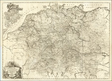
![[ Holy Roman Empire ] Germania, Non ea tantum quae Rheno, Vistula, Danubio, mariqz Germanico Veteribus claudebatur; Sed tota illa continens quae hodie communiter Germanica lingua utitur . . .](https://storage.googleapis.com/raremaps/img/small/99236.jpg)
![Plan eines Regulairen Laagers [Plan of a Regular Camp]](https://storage.googleapis.com/raremaps/img/small/93734.jpg)
![Drink Norden Kaffe [Germany]](https://storage.googleapis.com/raremaps/img/small/91604.jpg)
![[Holy Roman Empire] A Newe Mape of Germany Newly Augmented by Iohn Speed Ano Dom: 1626](https://storage.googleapis.com/raremaps/img/small/67323.jpg)
![(Second World War - Sudetenland) Wer Braucht Sicherheit im Südosten? [Who Needs Security in the Southeast?]](https://storage.googleapis.com/raremaps/img/small/98159.jpg)