The item illustrated and described below is sold, but we
have another example in stock. To view the example which
is currently being offered for sale, click the
"View Details" button below.


|
||

|

|
|

|
Stock# 31169
Description
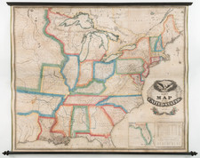
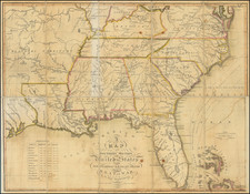
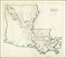
A fine example of Mathew Carey's map of Louisiana, one of the earliest large format maps of the state to appear in a commercial atlas.
Includes roads, towns, rivers, lakes, and a host of other details. Remarkable early detail, only 10 years after admission to the United States.