
This item has been sold, but you can enter your email address to be notified if another example becomes available.


|
||

|

|
|

|
Stock# 23735
Description
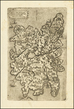
Striking chart of Corsica, with two large decorative cartouches and multiple compass roses.
Stunning image, finely colored and depicting in exacting detail the features of the coast of Corsica.
One of 16 charts in Henri Michelot and Laurent Bremond's] Carte Generalle dele Mer Mediterranee, which was originally published along with their work depicting the ports of the Mediterranean in 1718, with an English translation in 1725.
![[France] Europae Tabula III](https://storage.googleapis.com/raremaps/img/small/60010.jpg)
![Topographia aug. Turon[ensis] ducatus et confinium Galliae celticae sinu complectitur cuius latitudo ab aequinoctiali versus arcticum](https://storage.googleapis.com/raremaps/img/small/75142.jpg)
![(France, Belgium, and Holland) Tabula Moderna Francie [Modern Map of France]](https://storage.googleapis.com/raremaps/img/small/101885.jpg)
![Regionis Biturigum Exactiss: Descriptio Per D. Ioannem Calamaeum [with] Limaniae Topographia Gabriele Symeoneo Auct.](https://storage.googleapis.com/raremaps/img/small/61579.jpg)