|
||

|

|
|

|
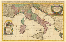
Striking and highly detailed map of the region around Rome, engraved by Giorgio Widman and published in Rome by Giacomo Rossi, the most important map maker working in Rome during the second half of the 17th Century.
Innocenzo Mattaei was appointed as the official cartographer to the Papal States by Pope Clemente X. The present map was originally prepared by Mattaei in 1666, and later engraved by Widman, and issued by the Rossi family in their
Mercurio Geographico. It represents perhaps the most accurate and detailed map of the region to appear in a commercial atlas of the period and reflects the skill of the engraver and the high quality of engraving work being done in Rome in the second half of the 17th Century. During this period a new generation of Italian map makers produced a number of decorative and important separately issued maps and atlases at a scale not scene since Lafreri and his contemporaries work in the 1560s and 1570s.
Giorgio Widman engraved a number of maps for Rossi from 1672 to 1682. He also appears to have done some work for Guillaume Sanson during the period.
Giacomo Giovanni Rossi (1627-1691) was an Italian engraver and printer. He worked in Rome, the heir to an important printing business founded by his father, Giuseppe de Rossi (1570-1639). Giuseppe began the press in 1633 and Giovanni and his brother, Giandomenico (1619-1653) took it over upon his death. The brothers expanded the business and by the mid-seventeenth century it was the best-known printing house in Rome.
For his maps, Giovanni worked with Giacomo Cantelli da Vignola. They produced the Atlas Mercurio Geografico. The first edition is undated, but the second was issued in 1692, a year after Giovanni’s death. The maps were by Cantelli. The firm also published maps based on those of Nicolas Sanson.
Later, the business passed to Lorenzo Filippo (1682-?). By 1738, the firm was known as Calcografia Camerale, then, from 1870 to 1945, as the Regia Calcografica. Today, the firm is still in business and is called Calcografia Nazionale. It operates as a free museum and offers one of the best collections of prints and plates in the world.
![Italy South Part. [Includes Sicily--large inset of Sardinia]](https://storage.googleapis.com/raremaps/img/small/103065.jpg)
![Regnum Siciliae Cum circumjacentibus Regnis et Insulis… [shows Malta] (Heighten with Gold Leaf)](https://storage.googleapis.com/raremaps/img/small/50376.jpg)