
This item has been sold, but you can enter your email address to be notified if another example becomes available.


|
||

|

|
|

|
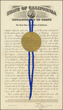
Stock# 17375
![(California Gold Rush Artist) [Autograph Letter, from American artist William McIlvaine Jr. to artist William Thompson Russell Smith, mentioning Fronconia Notch. White Mountains]](https://storage.googleapis.com/raremaps/img/small/97179.jpg)
![Mexico [with Southwestern U.S., Texas, etc.]](https://storage.googleapis.com/raremaps/img/small/97606.jpg)
![[ Used by '49ers To Travel To California ] Map of Oregon and Upper California from the surveys of John Charles Fremont and others authorities drawn by Charles Preuss 1848](https://storage.googleapis.com/raremaps/img/small/100557.jpg)
