|
||

|

|
|

|
A marvelous full color example of Bonne's scarce large format map of Florida, the Gulf Coast, Texas, Mexico, Baja California and Central America. In full original color, from a rare oversized composite atlas,.
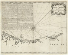
This example is corrected to 1782. Scale: 1 inch = approximately 65 miles. Unrecorded second state (the recoreded second state has date advanced to 1786 and publisher changed to Delamarche). Lowery 648n. Sellers & Van Ee, Maps and Charts of North America and the West Indies 1750-1789 1703: Covers the Southern United States, Mexico, Central America, and the West Indies. Shows provinces, numerous harbours and bays, towns, forts, channels, and a few routes of navigation. Also shows the direction of the trade winds, the Gulf Stream, and relief. Includes excellent detail along the coast of Florida, one of the best contemporary mappings of its coastline. Excellent detail in the Gulf Coast, including Texas, with a fair amount of detail in the interior. The treatment of Central America is also outstanding. Gorgeous example, in two sheets, unjoined as issued. There was also a third sheet covering the Caribbean issued.
Rigobert Bonne (1727-1794) was an influential French cartographer of the late-eighteenth century. Born in the Lorraine region of France, Bonne came to Paris to study and practice cartography. He was a skilled cartographer and hydrographer and succeeded Jacques Nicolas Bellin as Royal Hydrographer at the Depot de la Marine in 1773. He published many charts for the Depot, including some of those for the Atlas Maritime of 1762. In addition to his work at the Depot, he is best known for his work on the maps of the Atlas Encyclopedique (1788) which he did with Nicholas Desmarest. He also made the maps for the Abbe Raynals’ famous Atlas de Toutes Les Parties Connues du Globe Terrestre (1780).
More than his individual works, Bonne is also important for the history of cartography because of the larger trends exemplified by his work. In Bonne’s maps, it is possible to see the decisive shift from the elaborate decorations of the seventeenth century and the less ornate, yet still prominent embellishments of the early to mid-eighteenth century. By contrast, Bonne’s work was simple, unadorned, and practical. This aesthetic shift, and the detail and precision of his geography, make Bonne an important figure in mapping history.
![The North Coast of the Gulf of Mexico from St. Marks to Galveston . . . 1844 . . . Additions to 1856, including the Surveys of Comr. Powell, Lt. Simmes & Profr. Coffin, U.S. Navy [and] St. Marks to Galveston. Sheet II. . . . 1845. Additions to 1851 . . . .](https://storage.googleapis.com/raremaps/img/small/89497.jpg)