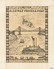
|
||

|

|
|

|
Promoting Oakland's Weston Tract, Oakland, 1889 (Mosswood)
Rare Broadsheet promotional maps and text promoting the sale of 125 lots in Oakland in October 1889. The area shown is between today's 40th Street and MacArthur, and between Telegraph and Broadway, near Mosswood Park.
This detailed map of the Weston Tract in Oakland, California, highlights 125 prime building lots offered for sale on October 16, 1889. Facilitated by D.J. Wheeler & Co., Real Estate Auctioneers from San Francisco, this sale presented what was desribed as a significant investment opportunity with the promise of easy terms, low interest, and perfect title. The auction, held on-site at 2:00 PM, was promoted to "prospective buyers seeking profitable real estate ventures in the rapidly developing city of Oakland."
The historical context of the Weston Tract sale is rooted in the late 19th-century boom of urban expansion in the San Francisco Bay Area. During this period, Oakland emerged as a pivotal hub due to its strategic location and burgeoning transportation infrastructure. The map explicitly notes the presence of frequent and efficient streetcar lines, which underscored the tract's accessibility and potential for residential development. This period saw Oakland transforming from a modest town into a significant urban center, driven by its connectivity to San Francisco and the wider Bay Area.
The map itself offers a comprehensive layout of the tract, bordered by notable streets such as Telegraph Avenue and Broadway. It delineates the parcel divisions with meticulous detail, showcasing avenues and streets like Evoy, Pearl, Ruby, and Silver. Each lot is clearly marked, emphasizing the organized planning that underpinned the tract's development. The promotional language highlights the advantageous southern, eastern, and western frontages of the lots, ensuring no undesirable north-facing plots, which were less favored for their cooler, less sunny disposition.
Prominent on the map is the advertisement of "Great Bargains" and "Cheap Homes," suggesting that the lots were competitively priced to attract a broad spectrum of buyers. The terms of purchase encouraged speculation: small cash payments and the option of deferred payments over two years with low interest, making property ownership accessible to many.
Furthermore, the map serves as an artifact of real estate marketing strategies of the late 1800s, blending persuasive sales pitches with practical information. The meticulous presentation of the Weston Tract, coupled with assurances of ready delivery and perfect title, aimed to build confidence and urgency among potential buyers. It reflects the era's burgeoning confidence in real estate as a stable and lucrative investment.

![[Post-Thanksgiving Troubles]](https://storage.googleapis.com/raremaps/img/small/68585.jpg)