


|
||

|

|
|

|
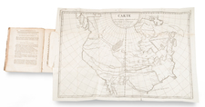
North America Immediately After The Treaty of Guadalupe Hidalgo
Terrific large format map of North America, issued shortly after the end of the Mexican War in 1848, but retaining a very curious British-centric depiction of the boundary between Oregon Territory and British America (Canada).
The map reflects the post-Guadalupe Hidalgo border with Mexico. Only Texas, Upper California and Oregon Territory are shown in the West, along with a massive Missouri Territory.
The details along the Sacramento River and its tributaries suggest that the map was issued shortly after the discovery of Gold in California.
In Oregon Territory, the British claims extend to the Columbia River, encroaching on the American claims to Puget Sound, despite this boundary dispute having been resolved by the Oregon Treaty of 1848.
New Mexico Territory and Utah Territory are now yet shown, both of which were established by 1850.
![Tabula Terre Nove [The Admiral's Map]](https://storage.googleapis.com/raremaps/img/small/81714.jpg)
![[The Rarest State] Americae Sive Novi Orbis Nova Descriptio](https://storage.googleapis.com/raremaps/img/small/80521.jpg)

![A New and Correct Map of North America with the West India Islands, Divided According to the Last Treaty of Peace ... 20th of Jan. 1783 ... Particularly Distinguished the Thirteen Provinces which Compose the United States . . . [With annotations describing Cumberland, Tennessee, Kentucky etc.]](https://storage.googleapis.com/raremaps/img/small/41651.jpg)
![[ Trans-Atlantic Cable ] Amerique Septentrionale avec l'indication des Principaux Courants marins d'Amerique en Europe](https://storage.googleapis.com/raremaps/img/small/98084.jpg)