|
||

|

|
|

|
Stock# 100504
Description
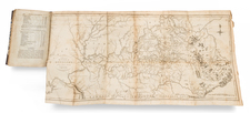
One of the earliest printed maps of the State of Kentucky.
The map provides a fine and extensive treatment of Kentucky's early roads. Numerous towns and courthouses are also shown, along with the Rapids below Louisville on the Ohio River.
Includes an early appearance of Fort Washington or Cincinnati on the Ohio River.
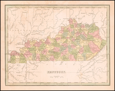
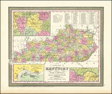
States of the Map
The map is known in four states:
- State 1 (1796): No roads shown.
- State 2 (1801): In the border, a line has been added through the numerals '85' and '10' degrees longitude. Buck Cr.is named directly below the label Ohio R. and Shelbyville, Springfield, Somerset, Franklin, Crab Cr and Preston are added.
- State 3 (1805): To the north of Kentucky, North Wn. Territory, and Ohio are shown above and Tennessee below. Many more place names and roads added.
- State 4 (1813): North Wn. Territory has been removed and replace with Illinois and Indiana.
Condition Description
Engraving on late 18th or early 19th century wove paper. Excellent tone and structural stability.
![(Southern Travel Journal) [Manuscript travel journal to Mobile, Alabama by Andrew Clark, Jr. of Methuen, Massachusetts, also by horseback through Kentucky and Tennessee and up the Mississippi north to Pittsburgh]](https://storage.googleapis.com/raremaps/img/small/93034.jpg)