
This item has been sold, but you can enter your email address to be notified if another example becomes available.


|
||

|

|
|

|
Stock# 100487
Description
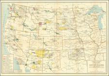
Unusual map of the United States, published in Philadelphia in about 1805.
The map shows the newly created state of Ohio (1802) and Indiana Territory (1800). Mississippi Territory (established in April 1798, with West Florida below it and Georgia above and to the east), is now shown in a more modern configuration, following the Georgia cession of 1804.
There is an earlier state of the map, which predates the appearances of Ohio, Indiana Territory and North West Territory, and includes an earlier spelling of "Tennasee" and curious boundary between Mississippi Territory and Georgia.
Condition Description
Small tear on neat line mended with archival tissue

![[United States]](https://storage.googleapis.com/raremaps/img/small/93852.jpg)