
Search
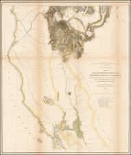
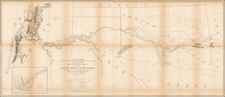
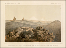
Place/Date:
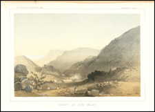
Washington / 1855
Size:
27.5 x 23 inches
Condition:
VG
Stock#:
49244
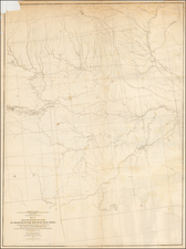
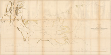
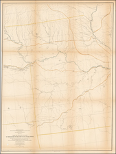
Place/Date:
Washington, D.C. / 1855
Size:
23.5 x 31 inches
Condition:
Good
Stock#:
55935
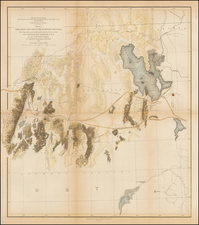
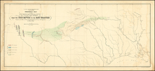
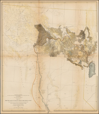
Place/Date:
Washington, D.C. / 1856
Size:
20.5 x 18 inches
Condition:
VG
Stock#:
49277
Place/Date:
Washington / 1860
Size:
9 x 6 inches
Condition:
VG
Stock#:
28598
Archived

Place/Date:
Washington / 1854
Size:
35.5 x 8 inches
Condition:
VG+
Stock#:
49190
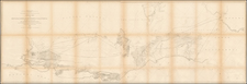
Place/Date:
Washington D.C. / 1854
Size:
22 x 50 inches
Condition:
VG
Stock#:
49001
Place/Date:
Washington D.C. / 1854
Size:
22 x 50 inches
Condition:
VG
Stock#:
56034

Place/Date:
Washington, D.C. / 1854
Size:
22.5 x 9.5 inches
Condition:
VG
Stock#:
61671
Place/Date:
Washington, D.C. / 1854
Size:
23.5 x 10.5 inches
Condition:
VG
Stock#:
61672
Place/Date:
Washington D.C. / 1854
Size:
22 x 50 inches
Condition:
VG
Stock#:
61867
Place/Date:
Washington, D.C. / 1854
Size:
20 x 13 inches
Condition:
VG+
Stock#:
84399
Place/Date:
Washington / 1855
Size:
9.5 x 7 inches
Condition:
VG+
Stock#:
0652
Place/Date:
Washington / 1855
Size:
9.5 x 7 inches
Condition:
VG+
Stock#:
0653
Place/Date:
Washington / 1855
Size:
9.5 x 7 inches
Condition:
VG+
Stock#:
0654
Place/Date:
Washington / 1855
Size:
9.5 x 7 inches
Condition:
VG
Stock#:
0655

Place/Date:
Washington / 1855
Size:
9.5 x 7 inches
Condition:
VG
Stock#:
0656
Place/Date:
Washington / 1855
Size:
9.5 x 7 inches
Condition:
VG
Stock#:
10648
Place/Date:
Washington / 1855
Size:
9.5 x 7 inches
Condition:
VG
Stock#:
11384
Place/Date:
Washington / 1855
Size:
9.5 x 7 inches
Condition:
VG
Stock#:
11390
Place/Date:
Washington / 1855
Size:
9.5 x 7 inches
Condition:
VG
Stock#:
11391

Place/Date:
Washington / 1855
Size:
9.5 x 7 inches
Condition:
VG
Stock#:
11392
Place/Date:
Washington / 1855
Size:
9.5 x 7 inches
Condition:
VG
Stock#:
11393
Place/Date:
Washington / 1855
Size:
9.5 x 7 inches
Condition:
VG
Stock#:
20403
Place/Date:
Washington / 1855
Size:
9.5 x 7 inches
Condition:
VG
Stock#:
20404
Place/Date:
Washington / 1855
Size:
9.5 x 7 inches
Condition:
VG
Stock#:
20405
Place/Date:
Washington / 1855
Size:
9.5 x 7 inches
Condition:
VG+
Stock#:
20960
Place/Date:
Washington / 1855
Size:
9.5 x 7 inches
Condition:
VG+
Stock#:
20961
Place/Date:
Washington / 1855
Size:
9.5 x 7 inches
Condition:
VG+
Stock#:
20962
Place/Date:
Washington / 1855
Size:
9.5 x 7 inches
Condition:
VG+
Stock#:
20963
Place/Date:
Washington / 1855
Size:
9.5 x 7 inches
Condition:
VG+
Stock#:
20964
Place/Date:
Washington / 1855
Size:
9.5 x 7 inches
Condition:
VG
Stock#:
23969

Place/Date:
Washington / 1855
Size:
9.5 x 7 inches
Condition:
VG+
Stock#:
24093
Place/Date:
Washington / 1855
Size:
9.5 x 7 inches
Condition:
VG+
Stock#:
24146

Place/Date:
Washington / 1855
Size:
9.5 x 7 inches
Condition:
VG+
Stock#:
24119

Place/Date:
Washington / 1855
Size:
9.5 x 7 inches
Condition:
VG
Stock#:
24662

Place/Date:
Washington / 1855
Size:
9.5 x 7 inches
Condition:
VG
Stock#:
26042

Place/Date:
Washington / 1855
Size:
9.5 x 7 inches
Condition:
VG+
Stock#:
28502
Place/Date:
Washington / 1855
Size:
9.5 x 7 inches
Condition:
VG
Stock#:
30781

Place/Date:
Washington / 1855
Size:
23 x 20 inches
Condition:
VG
Stock#:
31279

Place/Date:
Washington / 1855
Size:
9.5 x 7 inches
Condition:
VG+
Stock#:
31722
Place/Date:
Washington / 1855
Size:
27.5 x 23 inches
Condition:
VG
Stock#:
34139

Place/Date:
Washington / 1855
Size:
9.5 x 7 inches
Condition:
VG
Stock#:
34716
Place/Date:
Washington / 1855
Size:
9.5 x 7 inches
Condition:
VG+
Stock#:
34841
Place/Date:
Washington / 1855
Size:
9.5 x 7 inches
Condition:
VG
Stock#:
35052
Place/Date:
Washington / 1855
Size:
9.5 x 7 inches
Condition:
VG
Stock#:
35434
Place/Date:
Washington / 1855
Size:
9.5 x 7 inches
Condition:
VG
Stock#:
37207
Place/Date:
Washington / 1855
Size:
9.5 x 7 inches
Condition:
VG
Stock#:
37102
Place/Date:
Washington / 1855
Size:
9.5 x 7 inches
Condition:
VG
Stock#:
38683
Place/Date:
Washington / 1855
Size:
9.5 x 7 inches
Condition:
VG
Stock#:
38834
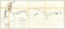
Place/Date:
Washington, D.C. / 1855
Size:
23.5 x 31 inches
Condition:
VG
Stock#:
49164
Place/Date:
Washington, D.C. / 1855
Size:
20.5 x 18 inches
Condition:
VG
Stock#:
49389
Place/Date:
Washington, D.C. / 1855
Size:
72 x 24 inches
Condition:
VG
Stock#:
50038

Place/Date:
Washington / 1855
Size:
9.5 x 7 inches
Condition:
VG
Stock#:
60503
Place/Date:
Washington / 1855
Size:
9.5 x 7 inches
Condition:
VG+
Stock#:
62231