
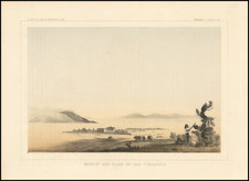
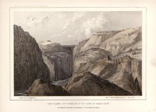
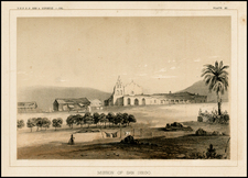
Search
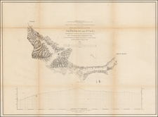
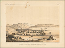
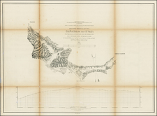
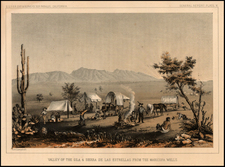
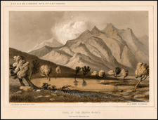
Place/Date:
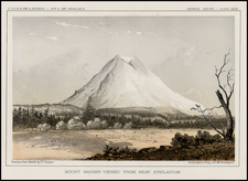
Washington / 1853
Size:
30 x 22 inches
Condition:
VG
Stock#:
49119
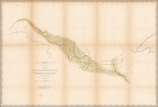
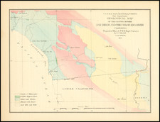
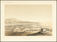
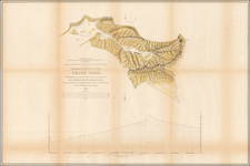
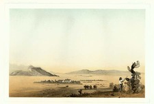
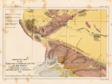
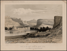
Place/Date:
Washington / 1854
Size:
37 x 24.75 inches
Condition:
VG
Stock#:
49047
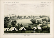
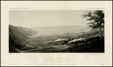
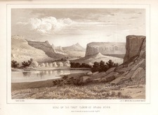
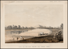
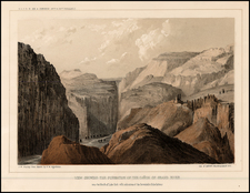
Place/Date:
Washington / 1855
Size:
9 x 7 inches
Condition:
VG
Stock#:
26803
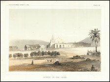
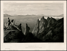
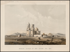
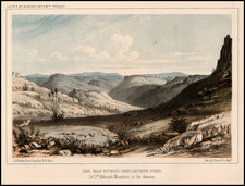
Place/Date:
Washington / 1855
Size:
9 x 7 inches
Condition:
VG+
Stock#:
77082
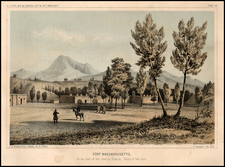
Place/Date:
Washington / 1855
Size:
9 x 7 inches
Condition:
VG
Stock#:
90063
Place/Date:
Washington / 1855
Size:
9 x 7 inches
Condition:
VG+
Stock#:
90138
Place/Date:
Washington / 1855
Size:
9.5 x 6.5 inches
Condition:
VG
Stock#:
90229
Place/Date:
Washington / 1855
Size:
9 x 7 inches
Condition:
VG
Stock#:
90289
Place/Date:
Washington / 1855
Size:
9.5 x 6.5 inches
Condition:
VG+
Stock#:
100003
Place/Date:
Washington / 1856
Size:
9.5 x 7 inches
Condition:
VG+
Stock#:
94583
Place/Date:
New York / 1857
Size:
16 x 22.25 inches
Condition:
VG
Stock#:
85298
Archived
Place/Date:
Washington / 1825
Size:
9.5 x 6.5 inches
Condition:
VG+
Stock#:
59614
Place/Date:
Washington / 1852
Size:
9.5 x 6.5 inches
Condition:
VG+
Stock#:
62863
Place/Date:
Washington / 1852
Size:
9.5 x 7 inches
Condition:
VG+
Stock#:
77032

Place/Date:
New York / 1853
Size:
22 x 16 inches
Condition:
VG+
Stock#:
1136
Place/Date:
New York / 1853
Size:
22 x 16 inches
Condition:
VG+
Stock#:
8512
Place/Date:
New York / 1853
Size:
22 x 16 inches
Condition:
VG
Stock#:
21519
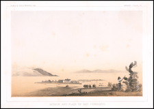
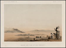
Place/Date:
Washington / 1853
Size:
30 x 22 inches
Condition:
VG
Stock#:
27100
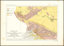
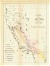
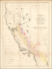
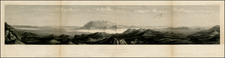
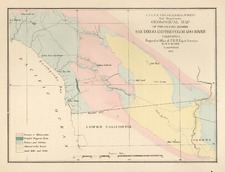
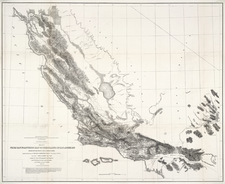
Place/Date:
Washington / 1853
Size:
23.5 x 35 inches
Condition:
VG
Stock#:
49009
Place/Date:
New York / 1853
Size:
22 x 16 inches
Condition:
VG
Stock#:
53889
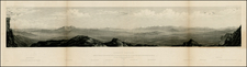
Place/Date:
Washington / 1854
Size:
30 x 8 inches
Condition:
VG
Stock#:
26584
Place/Date:
Washington / 1854
Size:
30 x 8 inches
Condition:
VG
Stock#:
26666
Place/Date:
Washington / 1854
Size:
30 x 8 inches
Condition:
VG
Stock#:
26742
Place/Date:
Washington / 1854
Size:
9 x 4.1 inches
Condition:
VG
Stock#:
26564
Place/Date:
Washington / 1854
Size:
9 x 6 inches
Condition:
VG
Stock#:
27328
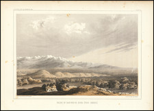
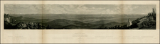
Place/Date:
Washington / 1854
Size:
36.5 x 24.5 inches
Condition:
VG
Stock#:
55934
Place/Date:
Washington / 1855
Size:
9.5 x 6.5 inches
Condition:
VG
Stock#:
0341
Place/Date:
Washington / 1855
Size:
9 x 7 inches
Condition:
VG
Stock#:
10594
Place/Date:
Washington / 1855
Size:
9.5 x 6.5 inches
Condition:
VG+
Stock#:
11385
Place/Date:
Washington / 1855
Size:
9.5 x 6.5 inches
Condition:
VG
Stock#:
11386
Place/Date:
Washington / 1855
Size:
9 x 7 inches
Condition:
VG
Stock#:
11388
Place/Date:
Washington / 1855
Size:
9 x 7 inches
Condition:
VG
Stock#:
11389
Place/Date:
Washington / 1855
Size:
9.5 x 6.5 inches
Condition:
VG
Stock#:
12682

Place/Date:
Washington / 1855
Size:
9.5 x 6.5 inches
Condition:
VG
Stock#:
3220
Place/Date:
Washington / 1855
Size:
9.5 x 6.5 inches
Condition:
VG+
Stock#:
6523
Place/Date:
Washington / 1855
Size:
9.5 x 6.5 inches
Condition:
VG
Stock#:
6524
Place/Date:
Washington / 1855
Size:
9.5 x 6.5 inches
Condition:
VG
Stock#:
18152

Place/Date:
Washington / 1855
Size:
9.5 x 6.5 inches
Condition:
VG
Stock#:
18153
Place/Date:
Washington / 1855
Size:
35 x 28.5 inches
Condition:
VG
Stock#:
18855
Place/Date:
Washington / 1855
Size:
9.5 x 6.5 inches
Condition:
VG+
Stock#:
19548
Place/Date:
Washington / 1855
Size:
9.5 x 6.5 inches
Condition:
VG
Stock#:
19549
Place/Date:
Washington / 1855
Size:
9 x 7 inches
Condition:
VG
Stock#:
19550
Place/Date:
Washington / 1855
Size:
9 x 7 inches
Condition:
VG
Stock#:
19551
Place/Date:
Washington / 1855
Size:
9 x 7 inches
Condition:
VG
Stock#:
19576
Place/Date:
Washington / 1855
Size:
9 x 7 inches
Condition:
VG
Stock#:
19649
Place/Date:
Washington / 1855
Size:
9 x 7 inches
Condition:
VG
Stock#:
19650
Place/Date:
Washington / 1855
Size:
9.5 x 6.5 inches
Condition:
VG
Stock#:
19652
Place/Date:
Washington / 1855
Size:
9.5 x 6.5 inches
Condition:
VG
Stock#:
19653
Place/Date:
Washington / 1855
Size:
9 x 7 inches
Condition:
VG
Stock#:
19709
Place/Date:
Washington / 1855
Size:
9 x 7 inches
Condition:
VG
Stock#:
19710
Place/Date:
Washington / 1855
Size:
9 x 7 inches
Condition:
VG
Stock#:
19711
Place/Date:
Washington / 1855
Size:
9 x 7 inches
Condition:
VG
Stock#:
19712
Place/Date:
Washington / 1855
Size:
9 x 7 inches
Condition:
VG
Stock#:
19713
Place/Date:
Washington / 1855
Size:
9 x 7 inches
Condition:
VG
Stock#:
19825
Place/Date:
Washington / 1855
Size:
9 x 7 inches
Condition:
VG
Stock#:
19826
Place/Date:
Washington / 1855
Size:
9 x 7 inches
Condition:
VG
Stock#:
19827
Place/Date:
Washington / 1855
Size:
9 x 7 inches
Condition:
VG
Stock#:
19828
Place/Date:
Washington / 1855
Size:
9 x 7 inches
Condition:
VG
Stock#:
19829
Place/Date:
Washington / 1855
Size:
9 x 7 inches
Condition:
VG
Stock#:
20033
Place/Date:
Washington / 1855
Size:
9 x 7 inches
Condition:
VG
Stock#:
20034
Place/Date:
Washington / 1855
Size:
9 x 7 inches
Condition:
VG
Stock#:
20035