|
||

|

|
|

|
Stock# 86971
Description
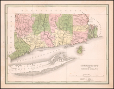
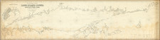
One of the earliest obtainable American published maps of Connecticut & Rhode Island.
Shows counties, townships, towns, rivers, islands, roads, points and many other details.
Issued in Morse's American Univeral Geography.
Condition Description
Engraving on 18th century laid paper. Loss at lower left neatline professionally reinstated in facsimile.
Reference
Wheat & Brun 287.